world.wikisort.org - Croatie
Bijelo Brdo (serbe : Бијело Брдо[1]) est un village de Croatie, situé à 15 km à l'est d'Osijek dans la région historique de Slavonie non loin de la frontière avec la Serbie. Il est rattaché au comitat de Osijek-Baranja.
Cet article est une ébauche concernant une localité croate.
Vous pouvez partager vos connaissances en l’améliorant (comment ?) selon les recommandations des projets correspondants.
Pour les articles homonymes, voir Bijelo Brdo.
| Bijelo Brdo Бијело Брдо[1] | ||||
 Héraldique |
||||

| ||||
| Administration | ||||
|---|---|---|---|---|
| Pays | ||||
| Comitat | Osijek-Baranja | |||
| Municipalité | Erdut | |||
| Indicatif téléphonique international | +(385) | |||
| Démographie | ||||
| Population | 2 119 hab. (2001) | |||
| Géographie | ||||
| Coordonnées | 45° 31′ 03″ nord, 18° 52′ 23″ est | |||
| Localisation | ||||
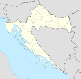
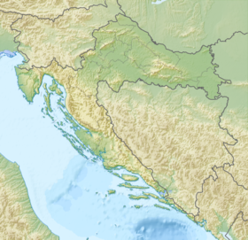
| Géolocalisation sur la carte : comitat d'Osijek-Baranja
Géolocalisation sur la carte : Croatie
Géolocalisation sur la carte : Croatie
| ||||
| modifier |
||||

Le village est habité par des Serbes et comptait 2 119 habitants au recensement de 2001.
Notes et références
 Portail de la Croatie
На других языках
[en] Bijelo Brdo, Croatia
Bijelo Brdo (Serbian Cyrillic: Бијело Брдо,[1] Hungarian: Darnó, German: Wellibardo) is a village in the Erdut municipality in eastern Croatia. It is connected by the D213 road and by R202 railway. It has a total of 1,961 inhabitants (2011).[es] Bijelo Brdo
Bijelo Brdo es una localidad de Croacia en el ejido del municipio de Erdut, condado de Osijek-Baranya.- [fr] Bijelo Brdo (Erdut)
Текст в блоке "Читать" взят с сайта "Википедия" и доступен по лицензии Creative Commons Attribution-ShareAlike; в отдельных случаях могут действовать дополнительные условия.
Другой контент может иметь иную лицензию. Перед использованием материалов сайта WikiSort.org внимательно изучите правила лицензирования конкретных элементов наполнения сайта.
Другой контент может иметь иную лицензию. Перед использованием материалов сайта WikiSort.org внимательно изучите правила лицензирования конкретных элементов наполнения сайта.
2019-2025
WikiSort.org - проект по пересортировке и дополнению контента Википедии
WikiSort.org - проект по пересортировке и дополнению контента Википедии