world.wikisort.org - Colombia
Gachancipá è un comune della Colombia facente parte del dipartimento di Cundinamarca.
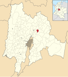
| Gachancipá comune | |||
|---|---|---|---|
| |||
 | |||
| Localizzazione | |||
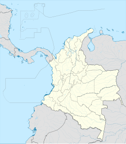
| Stato | |||
| Dipartimento | |||
| Amministrazione | |||
| Sindaco | Alfonso López Sánchez | ||
| Territorio | |||
| Coordinate | 5°00′00″N 73°53′00″W | ||
| Altitudine | 2,379 m s.l.m. | ||
| Superficie | 44 km² | ||
| Abitanti | 10 792[1] (2005) | ||
| Densità | 245,27 ab./km² | ||
| Altre informazioni | |||
| Fuso orario | UTC-5 | ||
| Nome abitanti | Gachancipeños | ||
| Cartografia | |||
 Gachancipá | |||
 | |||
| Sito istituzionale | |||


Il centro abitato venne fondato nel 1612.
Note
- (ES) Dati del censimento 2005 forniti dal DANE - Departamento Administrativo Nacional de Estadística (PDF), su dane.gov.co. URL consultato l'08-11-2009 (archiviato dall'url originale l'11 giugno 2008).
Altri progetti
 Wikimedia Commons contiene immagini o altri file su Gachancipá
Collegamenti esterni
- (ES) Scheda sul sito del dipartimento di Cundinamarca, su cundinamarca.gov.co. URL consultato l'08-11-2009.
На других языках
[en] Gachancipá
Gachancipá is a municipality and town of Colombia in the Central Savanna Province, part of the department of Cundinamarca. The urban centre is located on the Altiplano Cundiboyacense at 42 kilometres (26 mi) from the capital Bogotá. The municipality borders Guatavita and Tocancipá in the south, Sesquilé and Guatavita in the east, Nemocón in the west and Suesca in the north.[1]- [it] Gachancipá
Текст в блоке "Читать" взят с сайта "Википедия" и доступен по лицензии Creative Commons Attribution-ShareAlike; в отдельных случаях могут действовать дополнительные условия.
Другой контент может иметь иную лицензию. Перед использованием материалов сайта WikiSort.org внимательно изучите правила лицензирования конкретных элементов наполнения сайта.
Другой контент может иметь иную лицензию. Перед использованием материалов сайта WikiSort.org внимательно изучите правила лицензирования конкретных элементов наполнения сайта.
2019-2026
WikiSort.org - проект по пересортировке и дополнению контента Википедии
WikiSort.org - проект по пересортировке и дополнению контента Википедии