world.wikisort.org - Colombia
Tutunendo is a Colombian district of the municipality of Quibdó , located in the department of Chocó . It is located 14 km from Quibdó , on the Quibdó - Medellín road. Declared a site of greater rainfall and Biodiversity. Its economic activities are: Agriculture, fishing, exploitation and extraction of minerals and wood resources and tourism in the weekend season by tourists, mostly from the city of Quibdó.
Tutunendó | |
|---|---|
 Tutunendó Location in Chocó and Colombia 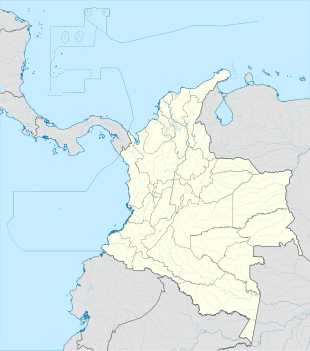 Tutunendó Tutunendó (Colombia) | |
| Coordinates: 5°44′37.0″N 76°32′16.1″W | |
| Country | |
| Department | Chocó |
| Municipality | Quibdó Municipality |
| Elevation | 177 ft (54 m) |
| Population (2005) | |
| • Total | 1,764[1] |
| Time zone | UTC-5 (Colombia Standard Time) |
The township of Tutunendo ( Quibdó municipality ) is part of the Chocó Biogeographic and has an area of 43 square kilometers where much of the biodiversity is housed as it is a humid rain forest, which has made the area considered the main tourist center of the municipality of Quibdó, as an appropriate place for recreation and research for environmental entities.
Climate
Tutunendo has an extremely wet tropical rainforest climate (Af). It is one of the wettest places on earth.
| Climate data for Tutunendo | |||||||||||||
|---|---|---|---|---|---|---|---|---|---|---|---|---|---|
| Month | Jan | Feb | Mar | Apr | May | Jun | Jul | Aug | Sep | Oct | Nov | Dec | Year |
| Average high °C (°F) | 30.0 (86.0) |
30.3 (86.5) |
30.6 (87.1) |
30.8 (87.4) |
31.1 (88.0) |
30.9 (87.6) |
31.1 (88.0) |
31.2 (88.2) |
30.9 (87.6) |
30.5 (86.9) |
30.3 (86.5) |
29.8 (85.6) |
30.6 (87.1) |
| Daily mean °C (°F) | 26.4 (79.5) |
26.7 (80.1) |
26.9 (80.4) |
26.9 (80.4) |
27.0 (80.6) |
26.8 (80.2) |
26.8 (80.2) |
26.8 (80.2) |
26.5 (79.7) |
26.3 (79.3) |
26.2 (79.2) |
26.2 (79.2) |
26.6 (79.9) |
| Average low °C (°F) | 23.4 (74.1) |
23.4 (74.1) |
23.5 (74.3) |
23.6 (74.5) |
23.5 (74.3) |
23.3 (73.9) |
23.1 (73.6) |
23.1 (73.6) |
23.1 (73.6) |
23.0 (73.4) |
23.1 (73.6) |
23.3 (73.9) |
23.3 (73.9) |
| Average rainfall mm (inches) | 874.2 (34.42) |
743.8 (29.28) |
764.8 (30.11) |
962.8 (37.91) |
1,062.9 (41.85) |
1,003.3 (39.50) |
1,070.9 (42.16) |
1,092.5 (43.01) |
1,073.7 (42.27) |
1,019.4 (40.13) |
1,020.6 (40.18) |
907.2 (35.72) |
11,596.1 (456.54) |
| Average rainy days | 20 | 17 | 18 | 21 | — | — | — | 24 | 23 | 22 | 24 | 22 | — |
| Source: [2] | |||||||||||||
References
- "Tutunendó (Quibdó, Chocó, Colombia) - Population Statistics, Charts, Map, Location, Weather and Web Information". www.citypopulation.de.
- "Data". www.ideam.gov.co. Retrieved 2020-06-26.
На других языках
- [en] Tutunendo
[es] Tutunendo
Tutunendo es un corregimiento colombiano del municipio de Quibdó, ubicado en el departamento del Chocó. Se encuentra a 14 km de Quibdó, por la vía Quibdó-Medellín. Declarado sitio de mayor pluviosidad y Biodiverso, con una población aproximada de 3.500 habitantes. Sus actividades económicas son: La Agricultura, la Pesca y una amplia explotación y extracción de Minerales y recursos Madereros, El turismo en temporada de fin de semana por turistas en su mayoría de la ciudad de Quibdó.[ru] Тутунендо
Тутунендо — населённый пункт в департаменте Чоко, на западе Колумбии.Другой контент может иметь иную лицензию. Перед использованием материалов сайта WikiSort.org внимательно изучите правила лицензирования конкретных элементов наполнения сайта.
WikiSort.org - проект по пересортировке и дополнению контента Википедии