world.wikisort.org - China
Yitunbulake Town (Chinese: 依吞布拉克镇; pinyin: Yītūnbùlākèzhèn; also Yetimbulak or Qilanbulak) is a town in Ruoqiang County, Bayin'gholin Mongol Autonomous Prefecture in southeastern Xinjiang, People's Republic of China.
Yitunbulake
依吞布拉克镇 Yetimbulak, Qilanbulak | |
|---|---|
Town | |
 Main street of Yitunbulake in 2007. | |
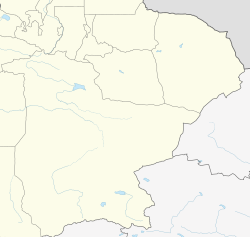 Yitunbulake Location in Xinjiang | |
| Coordinates: 38°23′7.4″N 90°09′16.99″E | |
| Country | China |
| Region | Xinjiang |
| Prefecture | Bayingolin Mongol Autonomous Prefecture |
| County | Ruoqiang |
| Founded | 1958, Officially established on November 5, 1983.[1][2] |
| Named for | Yitumbulak, a Uyghur word meaning lonely spring.[2] |
| Area | |
| • Total | 5.5 km2 (2.1 sq mi) |
| Elevation | 3,193 m (10,476 ft) |
| Population (2010)[5] | |
| • Total | 800 |
| • Density | 150/km2 (380/sq mi) |
| Time zone | UTC+8 (China Standard[6]) |
| Postal code | 841803 |
| Telephone area code | 0996 |
Location
The town lies at an altitude of 3,193 metres (10,476 ft),[4] South of the Altyn-Tagh mountain range and close to the Qinghai Province border.[3][5]
The China National Highway 315, linking Ruoqiang Town (256 kilometres (159 mi)) and Mangnai, passes Northeast of town, and other smaller roads lead to Tömürlük Township (to the Southeast) and Qimantag Township (320 kilometres (200 mi) to the South), as well as pastoral areas.[1][3][5]
Climate
Yitumbulak has a cold semi-arid climate, characterised by an extreme aridity. Spring is usually dry and windy, summer sees the majority of rainfall, autumn is mild and cool and winter is dry and cold, with little snow.[2]
- Average annual temperature: 12.8 °C (55.0 °F)
- Average temperature in January: −8.6 °C (16.5 °F)
- Average temperature in July: 26.7 °C (80.1 °F)
- Average annual frost-free period: 150 days
- Average annual sunshine hours: 2647.6 hours
- Total annual radiation: 127.4 kcal/cm2
- Average annual precipitation: 50.3 millimetres (1.98 in)[2]
History
In 1958, as the surrounding area developed mines of coal, lead, zinc and copper, and especially asbestos, a new mining town was created, and on November 5, 1983, the town of Yitunbulake (meaning "lonely spring" in Uyghur) was officially established.[1][2]
Administrative divisions
Yitunbulake Town has under its jurisdiction the communities of Yitunbulake (依吞布拉克社区居民委员会) and Arjin (阿尔金社区居民委员会).[1][7]
References
- "行政区划-若羌县人民政府网站" [Administrative Divisions - Ruoqiang County]. loulan.gov.cn (in Simplified Chinese). 若羌县人民政府网站 (Ruoqiang County People's Government Website). Retrieved 8 April 2021.
- 中华人民共和国民政部编; 李立国; 郭景平; 李宁平; 托乎提·亚克夫, eds. (August 2016). 中华人民共和国政区大典·新疆维吾尔自治区 [Compendium of Political Regions of the People's Republic of China: Xinjiang Uygur Autonomous Region] (in Simplified Chinese). Beijing: 中国社会出版社 (China Society Press). pp. 1137–1138.
- "1997年若羌县行政区划" [1997 Ruoqiang County Administrative Divisions]. xzqh.org (in Simplified Chinese). 行政区划网 (Administrative Zoning Website). 13 December 2010. Retrieved 8 April 2021.
- "Qilanbulak, China". GeoNames. Retrieved 8 April 2021.
- "若羌县历史沿革" [History of Ruoqiang County]. www.xzqh.org (in Simplified Chinese). 行政区划网 (Administrative Zoning Website). 30 January 2015. Retrieved 8 April 2021.
- Officially Beijing Time, but locals in Xinjiang observe a different offset. See Xinjiang#Time
- "2020年统计用区划代码和城乡划分代码" [Area codes and rural/urban division codes for 2020 statistics]. National Bureau of Statistics of China (in Simplified Chinese). Retrieved 8 April 2021.
Другой контент может иметь иную лицензию. Перед использованием материалов сайта WikiSort.org внимательно изучите правила лицензирования конкретных элементов наполнения сайта.
WikiSort.org - проект по пересортировке и дополнению контента Википедии