world.wikisort.org - Canada
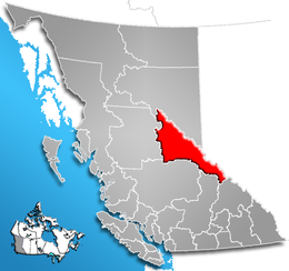
Il distretto regionale di Fraser-Fort George (RDFFG) è un distretto regionale della Columbia Britannica, Canada di 92.264 abitanti, che ha come capoluogo Prince George.
| Distretto regionale di Fraser-Fort George divisione censuaria | |
|---|---|
| Regional District of Fraser-Fort George | |
| Localizzazione | |
| Stato | |
| Provincia | |
| Amministrazione | |
| Capoluogo | Prince George |
| Lingue ufficiali | inglese |
| Territorio | |
| Coordinate del capoluogo | 53°54′36″N 122°46′12″W |
| Superficie | 51 083,73 km² |
| Abitanti | 92 264 (2006) |
| Densità | 1,81 ab./km² |
| Altre informazioni | |
| Fuso orario | UTC-8 |
| Cartografia | |
 | |
| Sito istituzionale | |

Comunità
- Città e comuni
- Prince George (city)
- Mackenzie (municipalità di distretto)
- Villaggi e aree esterne ai comuni
- McBride
- Valemount
- Fraser-Fort George A (Salmon River & Lakes)
- Fraser-Fort George C (Chilako River-Nechako)
- Fraser-Fort George D (Tabor Lake-Stone Creek)
- Fraser-Fort George E (Woodpecker-Hixon)
- Fraser-Fort George F (Willow River-Upper Fraser)
- Fraser-Fort George G (Crooked River-Parsnip)
- Fraser-Fort George H (Robson Valley-Canoe)
Collegamenti esterni
- Dettagli da Statistics Canada, su www12.statcan.ca.
- Carta dettagliata (GIF), su bcstats.gov.bc.ca. URL consultato il 3 agosto 2010 (archiviato dall'url originale il 31 gennaio 2012).
На других языках
[en] Regional District of Fraser–Fort George
The Regional District of Fraser–Fort George (RDFFG) is a regional district located in the Central Interior of British Columbia. It is bounded by the Alberta border to the east, the Columbia–Shuswap and Thompson–Nicola regional districts to the south and southeast, Cariboo Regional District to the southwest, the Regional District of Bulkley–Nechako to the west, and the Peace River Regional District to the north and northeast. As of the Canada 2011 Census, Fraser–Fort George had a population of 91,879 and a land area of 51,083.73 km2 (19,723.54 sq mi). The offices of the regional district are located at Prince George.- [it] Distretto regionale di Fraser-Fort George
Текст в блоке "Читать" взят с сайта "Википедия" и доступен по лицензии Creative Commons Attribution-ShareAlike; в отдельных случаях могут действовать дополнительные условия.
Другой контент может иметь иную лицензию. Перед использованием материалов сайта WikiSort.org внимательно изучите правила лицензирования конкретных элементов наполнения сайта.
Другой контент может иметь иную лицензию. Перед использованием материалов сайта WikiSort.org внимательно изучите правила лицензирования конкретных элементов наполнения сайта.
2019-2026
WikiSort.org - проект по пересортировке и дополнению контента Википедии
WikiSort.org - проект по пересортировке и дополнению контента Википедии