world.wikisort.org - Canada
Tête Jaune Cache est un village situé dans la province de la Colombie-Britannique, dans le centre-est[1].
Cet article est une ébauche concernant une localité canadienne et la Colombie-Britannique.
Vous pouvez partager vos connaissances en l’améliorant (comment ?) selon les recommandations des projets correspondants.
| Tête Jaune Cache | ||||

| ||||
| Administration | ||||
|---|---|---|---|---|
| Pays | ||||
| Province | ||||
| Région | centre-est de Colombie-Britannique | |||
| Statut municipal | Village | |||
| Démographie | ||||
| Population | 500 hab. (2006) | |||
| Géographie | ||||
| Coordonnées | 52° 58′ 00″ nord, 119° 25′ 44″ ouest | |||
| Divers | ||||
| Fuseau horaire | -8 | |||
| Indicatif | 250 / 778 / 236 | |||
| Localisation | ||||
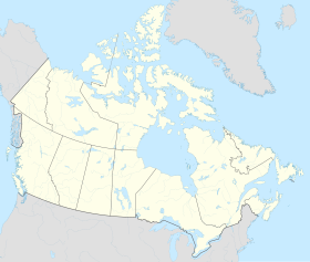
| Géolocalisation sur la carte : Canada
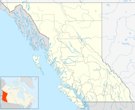
Géolocalisation sur la carte : Colombie-Britannique
Géolocalisation sur la carte : Colombie-Britannique
| ||||
| modifier |
||||

Notes et références
- (en) Cet article est partiellement ou en totalité issu de l’article de Wikipédia en anglais intitulé « Tête Jaune Cache, British Columbia » (voir la liste des auteurs).
 Portail de la Colombie-Britannique
На других языках
[en] Tête Jaune Cache, British Columbia
Tête Jaune Cache (/tɛt ʒoʊn kæʃ/) is an unincorporated rural area and the site of an important abandoned historic town in British Columbia, Canada.[1] Its population is approximately 500.[2] It is located on the Fraser River in the Robson Valley at the intersection of Yellowhead Highways 5 and 16. Tête Jaune Cache is located 18 km north of Valemount, B.C., 101 km west of Jasper, Alberta, 241 km east of Prince George, B.C., and 332 km north of Kamloops, B.C., by road.[3]- [fr] Tête Jaune Cache
Текст в блоке "Читать" взят с сайта "Википедия" и доступен по лицензии Creative Commons Attribution-ShareAlike; в отдельных случаях могут действовать дополнительные условия.
Другой контент может иметь иную лицензию. Перед использованием материалов сайта WikiSort.org внимательно изучите правила лицензирования конкретных элементов наполнения сайта.
Другой контент может иметь иную лицензию. Перед использованием материалов сайта WikiSort.org внимательно изучите правила лицензирования конкретных элементов наполнения сайта.
2019-2026
WikiSort.org - проект по пересортировке и дополнению контента Википедии
WikiSort.org - проект по пересортировке и дополнению контента Википедии