world.wikisort.org - Canada
Tay est un canton du Centre de l'Ontario, au Canada, situé au sud de la baie Georgienne.
| Tay | |||

| |||
| Administration | |||
|---|---|---|---|
| Pays | |||
| Province | |||
| Statut municipal | Canton | ||
| Maire | Scott Warnock | ||
| Constitution | 1993 | ||
| Démographie | |||
| Population | 9 748 hab. (2006) | ||
| Densité | 70 hab./km2 | ||
| Géographie | |||
| Coordonnées | 44° 43′ 00″ nord, 79° 46′ 00″ ouest | ||
| Superficie | 13 893 ha = 138,93 km2 | ||
| Divers | |||
| Fuseau horaire | UTC-5 | ||
| Localisation | |||
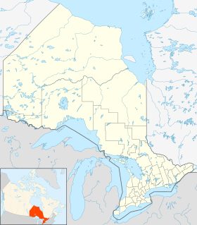
| Géolocalisation sur la carte : Ontario
Géolocalisation sur la carte : Ontario
| |||
| Liens | |||
| Site web | Township of Tay | ||
| modifier |
|||

Communautés
Le canton comprend les villages de Waubaushene, Victoria Harbour, Port McNicoll, Vasey, et plusieurs autres hameaux ruraux.
Wyebridge est un village/hameau du canton de Tiny.
 |
 |
Démographie
D'après le recensement canadien de 2006 :
- Population: 9,748 (9,162 en 2001)
- % Changement (2001-2006): 6,4
- % Changement (1996-2001): 1,3
- Logements: 3 470
- Superficie (km²): 138,93
- Densité (habitants par km²): 70,2

Personnalités
- Amos Arbour, ancien joueur de hockey sur glace
Notes et références
Liens externes
 Portail de l’Ontario
На других языках
[en] Tay, Ontario
Tay is a township in Central Ontario, Canada, located in Simcoe County in the southern Georgian Bay region. The township was named in 1822 after a pet dog of Lady Sarah Maitland (1792–1873), wife of Sir Peregrine Maitland, Lieutenant Governor of Upper Canada. Two other adjoining townships were also named for her pet dogs, Tiny and Flos (now Springwater Township).[3]- [fr] Tay (Ontario)
Текст в блоке "Читать" взят с сайта "Википедия" и доступен по лицензии Creative Commons Attribution-ShareAlike; в отдельных случаях могут действовать дополнительные условия.
Другой контент может иметь иную лицензию. Перед использованием материалов сайта WikiSort.org внимательно изучите правила лицензирования конкретных элементов наполнения сайта.
Другой контент может иметь иную лицензию. Перед использованием материалов сайта WikiSort.org внимательно изучите правила лицензирования конкретных элементов наполнения сайта.
2019-2026
WikiSort.org - проект по пересортировке и дополнению контента Википедии
WikiSort.org - проект по пересортировке и дополнению контента Википедии