world.wikisort.org - Canada
Sechelt est une municipalité de Colombie-Britannique située dans la partie inférieure de la Sunshine Coast à environ 50 km au nord-ouest de Vancouver.
| Sechelt | ||||
 Localisation | ||||
| Administration | ||||
|---|---|---|---|---|
| Pays | ||||
| Province | Colombie-Britannique | |||
| Région | Sunshine Coast | |||
| Subdivision régionale | District régional de Sunshine Coast | |||
| Maire | Bruce Milne | |||
| Constitution | ||||
| Démographie | ||||
| Population | 10 200 hab. (2016) | |||
| Densité | 257 hab./km2 | |||
| Géographie | ||||
| Coordonnées | 49° 28′ 27″ nord, 123° 45′ 14″ ouest | |||
| Superficie | 3 971 ha = 39,71 km2 | |||
| Divers | ||||
| Fuseau horaire | PST (UTC-8) | |||
| Localisation | ||||
| Géolocalisation sur la carte : Canada
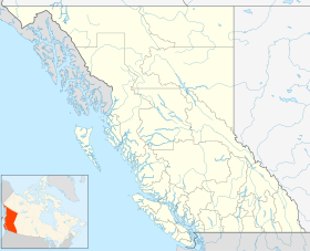
Géolocalisation sur la carte : Colombie-Britannique
Géolocalisation sur la carte : Colombie-Britannique
| ||||
| Liens | ||||
| Site web | http://www.sechelt.ca/ | |||
| modifier |
||||

Sechelt est accessible depuis la partie continentale de la Colombie-Britannique par un trajet en ferry de 40 minutes entre Horseshoe Bay et Langdale et à 25 minutes en voiture de Langdale par la British Columbia Highway 101 (en).
Histoire
Les premiers habitants de Sechelt sont ceux de la nation Sechelt ou shishalh[1]. En langue Sechelt, elle porte le nom de Ch'atlich[2].
Les premiers européens s'y installent vers 1860 et dans les années 1880. Sechelt devient un centre actif d'exploitations forestières et de pêche. Les oblats de Marie-Immaculée y construisent une église catholique romaine (Notre-Dame du Rosaire) qui est terminée en 1890[3] mais disparait dans un incendie en 1906. Un an plus tard une nouvelle église est établie à l'effigie de Notre-Dame de Lourdes mais brûle à son tour en [4].

Le village original de Sechelt a été constitué en corporation le . En 1986, il a élargi ses limites en incluant un certain nombre de secteurs non incorporés adjacents. Le district de Sechelt, tel qu'il est connu aujourd'hui, couvre environ 39,71 km² de l'isthme de la péninsule Sechelt, entre la pointe sud de l'inlet Sechelt et le détroit de Géorgie.
Démographie
Galerie
 Cowrie Street, rue principale de Sechelt
 Trail Bay, et la digue qui longe celle-ci, à l'extrémité sud du village
 Porpoise Bay, à l'extrémité sud de l'inlet Sechelt, situé à l'extrémité nord du village.


Notes et références
- Ron C. Beaumont, Sechelt Dictionary, Harbour Publishing, 2011, p. VIII
- Ibid, p. 380
- Charles Hill-Tout, The Salish People, vol. IV, Talon Books, 1978, p. 93
- John Veillete, Early Indian Village Churches, University of British Columbia Press, 1977, p. 36
- « Statistique Canada - Profils des communautés de 2006 - Sechelt » (consulté le )
- « Statistique Canada - Profils des communautés de 2016 - Sechelt » (consulté le )
Liens externes
- Notices d'autorité :
 Portail de la Colombie-Britannique
На других языках
[de] Sechelt (British Columbia)
Sechelt ist eine Kleinstadt in der kanadischen Provinz British Columbia. Sie befindet sich an der Sunshine Coast gegenüber von Vancouver Island.[en] Sechelt
Sechelt (/ˈsiːʃɛlt/, Shishalh language chat'lich[3]) is a district municipality located on the lower Sunshine Coast of British Columbia. Approximately 50 km northwest of Vancouver, it is accessible from mainland British Columbia by a 40-minute ferry trip between Horseshoe Bay and Langdale, and a 25-minute drive from Langdale along Highway 101, also known as the Sunshine Coast Highway. The name Sechelt is derived from the Sechelt language word, shishalh, the name of the First Nations people who first settled the area thousands of years ago.- [fr] Sechelt (Colombie-Britannique)
Другой контент может иметь иную лицензию. Перед использованием материалов сайта WikiSort.org внимательно изучите правила лицензирования конкретных элементов наполнения сайта.
WikiSort.org - проект по пересортировке и дополнению контента Википедии