world.wikisort.org - Canada
Lac-Pythonga est un territoire non organisé situé dans la municipalité régionale de comté de La Vallée-de-la-Gatineau, dans la région administrative de l'Outaouais, au Québec[1].
Cet article est une ébauche concernant l’Outaouais.
Vous pouvez partager vos connaissances en l’améliorant (comment ?) selon les recommandations des projets correspondants.
| Lac-Pythonga | |||||
 Lac Jean-Peré à Lac-Pythonga | |||||
| Administration | |||||
|---|---|---|---|---|---|
| Pays | |||||
| Province | |||||
| Région | Outaouais | ||||
| Subdivision régionale | La Vallée-de-la-Gatineau | ||||
| Statut municipal | territoire non organisé | ||||
| Constitution | |||||
| Démographie | |||||
| Population | 2 hab. () | ||||
| Densité | 0 hab./km2 | ||||
| Géographie | |||||
| Coordonnées | 46° 23′ 00″ nord, 76° 26′ 00″ ouest | ||||
| Superficie | 593 470 ha = 5 934,7 km2 | ||||
| Divers | |||||
| Code géographique | 2483902 | ||||
| Localisation | |||||
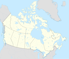
| Géolocalisation sur la carte : Canada
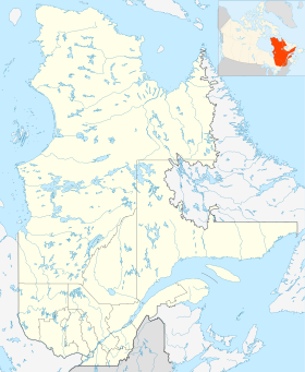
Géolocalisation sur la carte : Québec
Géolocalisation sur la carte : Outaouais (Québec)
Géolocalisation sur la carte : Outaouais (Québec)
| |||||
| modifier |
|||||

Géographie

Dans la MRC : La Vallée-de-la-Gatineau.
Il couvre une superficie de 5 130,08 km2[2].
Municipalités limitrophes
 |
Réservoir-Dozois | Senneterre, Lac-Lenôtre |
| |
| N | Cascades-Malignes, Montcerf-Lytton | |||
| O Lac-Pythonga E | ||||
| S | ||||
| Lac-Nilgaut | Cayamant, Kitigan Zibi | |||
| Enclave : Lac-Rapide | ||||
Toponymie
Son nom signifie en algonquin : « il y a long de sable où s'approcher en pagayant »[3].
Histoire
Cette section est vide, insuffisamment détaillée ou incomplète. Votre aide est la bienvenue ! Comment faire ?
Démographie
Cette section est vide, insuffisamment détaillée ou incomplète. Votre aide est la bienvenue ! Comment faire ?
Notes et références
- Gouvernement du Québec, « Lac-Pythonga », Répertoire des municipalités, sur Ministère des Affaires municipales, des Régions et de l'Occupation du territoire
- Statistique Canada : Lac-Pythonga
- Toponymie : Lac-Pythonga
Annexes
Articles connexes
- Rivière du Hibou (rivière de l'Aigle), un cours d'eau
- Rivière Bélinge, un cours d'eau
- Rivière à la Carpe (rivière Gens de Terre), un cours d'eau
- Rivière des Seize, un cours d'eau
- Rivière Ignace, un cours d'eau
- La Vallée-de-la-Gatineau, une municipalité régionale de comté (MRC)
- Rivière Gatineau, un cours d'eau
Liens externes
- Ressources relatives à la géographie :
 Portail de l'Outaouais
На других языках
[en] Lac-Pythonga
Lac-Pythonga is an unorganized territory in the Outaouais region of Quebec, Canada. It surrounds Lake Pythonga and is the largest of the five unorganized territories in the La Vallée-de-la-Gatineau Regional County Municipality.- [fr] Lac-Pythonga
Текст в блоке "Читать" взят с сайта "Википедия" и доступен по лицензии Creative Commons Attribution-ShareAlike; в отдельных случаях могут действовать дополнительные условия.
Другой контент может иметь иную лицензию. Перед использованием материалов сайта WikiSort.org внимательно изучите правила лицензирования конкретных элементов наполнения сайта.
Другой контент может иметь иную лицензию. Перед использованием материалов сайта WikiSort.org внимательно изучите правила лицензирования конкретных элементов наполнения сайта.
2019-2026
WikiSort.org - проект по пересортировке и дополнению контента Википедии
WikiSort.org - проект по пересортировке и дополнению контента Википедии