world.wikisort.org - Canada
Southesk is a civil parish in Northumberland County, New Brunswick, Canada.[2]
Southesk | |
|---|---|
Parish | |
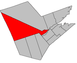 Location within Northumberland County, New Brunswick | |
| Coordinates: 46.9775°N 66.48°W | |
| Country | |
| Province | |
| County | Northumberland |
| Erected | 1879 |
| Area | |
| • Land | 2,462.60 km2 (950.82 sq mi) |
| Population (2021)[1] | |
| • Total | 1,666 |
| • Density | 0.7/km2 (2/sq mi) |
| • Change 2016-2021 | |
| • Dwellings | 813 |
| Time zone | UTC-4 (AST) |
| • Summer (DST) | UTC-3 (ADT) |
| Figures do not include portion within the Red Bank 4 Indian reserve | |
For governance purposes it is divided between the Indian reserve of Red Bank 4 and the local service district of the parish of South Esk,[3] which is a member of the Greater Miramichi Regional Service Commission (GMRSC).[4]
Origin of name
The parish takes its name from its position relative to Northesk Parish.[5]
History
Southesk was erected in 1879 from Northesk Parish south of the Northwest Miramichi River and a northwestern line starting at the mouth of the Little Southwest Miramichi River.[6] The Derby Parish boundary was significantly differently than it is today.
Boundaries
Southesk Parish is bounded:[2][7][8]
- on the north, beginning on the Victoria County line at a point about 150 metres south-southeast of Route 385, then running south 45º east[lower-alpha 1] to the mouth of the Little Southwest Miramichi River, then down the Northwest Miramichi River to a point about 825 metres downstream of the Route 8 bridge;
- on the east by line from the middle of the Northwest Miramichi River to the northeastern corner of a grant to Charles Vye Sr., about 700 metres east of Enclosure Road;
- on the south by a line beginning at the northeastern corner of the Vye grant, then westerly in a straight line 116 chains (about 2.3 kilometres) to the southeastern line of a grant to Stephen Sherwood at a point about 700 metres slightly east of south of the junction of Route 420 and Creamer Road, then northwesterly to Old Creamer Road, then southwesterly about 600 metres along Old Creamer Road to the southwestern line of a grant to James Oxford, then northwesterly along the Oxford grant to its westernmost corner, then southwesterly and northwesterly along the rear line of grants on the Southwest Miramichi River, then northwesterly and southwesterly to exclude a grant to Jared Betts on the northeastern side of Williamstown Road, then southeasterly along Williamstown Road to rejoin the rear line of Southwest Miramichi River grants, then generally southwesterly along the river grants before turning westerly to exclude several inland grants straddling Route 8 south of Crocker Lake, then southwesterly to Route 8 at the northwest line of the Elm Tree Tract granted to William Davidson, then southwesterly along the Elm Tree Tract and its prolongation to the Blackville Parish line, about 1.8 kilometres northwesterly of Route 8, then northwesterly about 7 kilometres along a line running north 22º west[lower-alpha 2] from the mouth of the Renous River, then south 72º west by an astronomic bearing to the York County line;
- on the west by the York and Victoria county lines.
Evolution of boundaries
Southesk has had the same western, northern, and eastern boundaries from the its creation; the boundary with Derby was a straight line running a line running south 68º west[lower-alpha 3] from modern Wilsons Point.[6]
In 1920 the boundary with Derby Parish was changed to run along property and grant lines.[14] The wording was ambiguous enough to require clarification in 1953[15] and 1954.[16] The 1954 Act also changed the wording of the boundary with Blackville, Blissfield, and Ludlow Parishes to run partly by an astronomic rather than a magnetic bearing.
Communities
Communities at least partly within the parish.[7][8][17] bold indicates an Indian reserve
- Cassilis
- Dennis
- Garden Road
- Halcomb
- Harris Brook Settlement
- Loggie Lodge
- Lyttleton
- Matthews
- Pratts Camp
- Ramsay Lodge
- Red Bank
- Red Bank 4
- Red Bank 7
- Red Rock
- Sillikers
- South Esk
- Warwick Settlement
- Williamstown
Bodies of water
Bodies of water[lower-alpha 4] at least partly within the parish.[7][8][17]
- Big Sevogle River
- Dungarvon River
- Little Sevogle River
- Little Southwest Miramichi River
- Northwest Miramichi River
- Renous River
- Serpentine River
- Tuadook River
- Crooked Deadwater
- The Horseback
- Little Ottawa Branch
- Northwest Inlet
- Guagus Stream
- Mullin Stream
- North Pole Stream
- Catamaran Lake
- Holmes Lake
- Little Trousers Lakes
- Lost Beaver Lake
- more than eighty other officially named lakes
Islands
Islands at least partly within the parish.[7][8][17]
- Gibbons Island
- Johnsons Island
Other notable places
Parks, historic sites, and other noteworthy places at least partly within the parish.[7][8][17][18][19]
- Adder Lakes Protected Natural Area
- Christmas Mountains
- Gover Mountain Protected Natural Area
- Kennedy Lakes Protected Natural Area
- Little Southwest Miramichi River Protected Natural Area
- Lower North Branch Little Southwest Miramichi River Protected Natural Area
- McCarty Brook Protected Natural Area
- McNeal Brook Protected Natural Area
- Miller Brook Protected Natural Area
- Nalaisk Mountain Protected Natural Area
- North Pole Stream Protected Natural Area
- Patchell Brook Protected Natural Area
- Plaster Rock-Renous Wildlife Management Area
- Tauadook River Protected Natural Area
- Upper Dungarvon River Protected Natural Area
- Wilson's Point Wildlife Refuge
Demographics
Parish population total does not include Indian reserves
Population
|
LanguageMother tongue language (2006)[23]
|
See also
- List of parishes in New Brunswick
Notes
- By the magnet of 1879,[6] when declination in the area was between 22º and 23º west of north.[9] The Territorial Division Act clause referring to magnetic direction bearings was omitted in the 1952[10] and 1973 Revised Statutes.[2]
- By the magnet of 1850,[11] when declination in the area was between 20º and 21º west of north.[9]
- By the magnet of 1814,[12] when declination in the area was between 16º and 17º west of north.[13]
- Not including brooks, ponds or coves.
References
- "Census Profile". Statistics Canada. 26 October 2022. Retrieved 30 October 2022.
- "Chapter T-3 Territorial Division Act". Government of New Brunswick. Retrieved 13 November 2020.
- "New Brunswick Regulation 84-168 under the Municipalities Act (O.C. 84-582)". Government of New Brunswick. Retrieved 19 July 2020.
- "Communities in each of the 12 Regional Service Commissions (RSC) / Les communautés dans chacune des 12 Commissions de services régionaux (CSR)" (PDF), Government of New Brunswick, July 2017, retrieved 2 February 2021
- Ganong, William F. (1896). A Monograph of the Place-Nomenclature of the Province of New Brunswick. Royal Society of Canada. p. 273. Retrieved 17 March 2021.
- "42 Vic. c. 37 An Act to erect part of the Parish of Northesk, in the County of Northumberland, into a separate Parish.". Acts of the General Assembly of Her Majesty's Province of New Brunswick. Passed in the Month of April 1879. Fredericton: Government of New Brunswick. 1879. pp. 77–78. Available as a free ebook from Google Books.
- "No. 47". Provincial Archives of New Brunswick. Department of Natural Resources and Energy Development. Retrieved 18 June 2021. Remainder of parish on maps 48, 56–59, 66–69, 75, and 76 at same site.
- "126" (PDF). Transportation and Infrastructure. Government of New Brunswick. Retrieved 18 June 2021. Remainder of parish on mapbooks 127, 148–150, 166–169, 182–187, 198–204, 213–218, and 228–230 at same site.
- "Historical Magnetic Declination". National Oceanic and Atmospheric Administration. Retrieved 12 March 2021.
- "Chapter 227 Territorial Division Act". The Revised Statutes of New Brunswick 1952 Volume III. Fredericton: Government of New Brunswick. 1952. pp. 3725–3771. Scans of this Act may be requested from the Legislative Library of New Brunswick.
- "13 Vic. c. 51 An Act to consolidate all the Laws now in force for the division of the Province into Counties, Towns and Parishes.". Acts of the General Assembly of Her Mjaesty's Province of New Brunswick, Passed in the Year 1850. Fredericton: Government of New Brunswick. 1850. pp. 142–152, 145–149. Retrieved 27 March 2021. Book was poorly proofread, resulting in title typo and reuse of page numbers 145–152.
- "54 Geo. III c. 17 An Act in further addition to an Act, intituled 'An Act for the better ascertaining and confirming the boundaries of the several Counties, within this Province, and for subdividing them into Towns or Parishes.'". Acts of the General Assembly of His Majesty's Province of New-Brunswick; Passed in the Year 1814. Saint John, New Brunswick: Government of New Brunswick. 1814. pp. 16–18. Retrieved 20 March 2021.
- "Historical Magnetic Declination". National Oceanic and Atmospheric Administration. Retrieved 13 March 2021.
- "9 Geo. V c. 55 An Act to amend Chapter 2 of the Consolidated Statutes, 1903, respecting the division of the Province into Counties, Towns and Parishes.". Acts of the Legislative Assembly of New Brunswick Passed in the Month of April 1919. Fredericton: Government of New Brunswick. 1919. pp. 258–265.
- "2 Elizabeth II, 1952, c. 81 An Act to Amend the Territorial Division Act". Acts of the Legislature of New Brunswick Passed During the Session of 1953. Fredericton: Government of New Brunswick. 1953. p. 202.
- "3 Elizabeth II, 1954, c. 83 An Act to Amend the Territorial Division Act". Acts of the Legislature of New Brunswick Passed During the Session of 1954. Fredericton: Government of New Brunswick. 1954. pp. 189–191.
- "Search the Canadian Geographical Names Database (CGNDB)". Government of Canada. Retrieved 7 July 2021.
- "Explore New Brunswick's Protected Natural Areas". GeoNB. Retrieved 2 July 2021.
- "New Brunswick Regulation 94-43 under the Fish and Wildlife Act (O.C. 94-231)". Government of New Brunswick. 5 June 2006. Retrieved 8 July 2021.
- Statistics Canada: 1996, 2001, 2006 census
- 2011 Statistics Canada Census Profile: Southesk Parish, New Brunswick
- "Census Profile, 2016 Census: Southesk, Parish [Census subdivision], New Brunswick". Statistics Canada. Retrieved 28 August 2019.
- 2006 Statistics Canada Community Profile: Southesk Parish, New Brunswick
Places adjacent to Southesk Parish, New Brunswick | |
|---|---|
Subdivisions of New Brunswick | |
|---|---|
| Subdivisions |
|
| Cities | |
| Counties | |
| |
Другой контент может иметь иную лицензию. Перед использованием материалов сайта WikiSort.org внимательно изучите правила лицензирования конкретных элементов наполнения сайта.
WikiSort.org - проект по пересортировке и дополнению контента Википедии