world.wikisort.org - Canada
Saint-Marie (originally Saint Mary),[lower-alpha 1] is a civil parish in Kent County, New Brunswick, Canada.[2]
Saint-Marie
Saint Mary, St. Mary, Ste. Marie | |
|---|---|
Parish | |
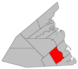 Location within Kent County, New Brunswick. | |
| Coordinates: 46.39°N 64.8725°W | |
| Country | |
| Province | |
| County | Kent |
| Erected | 1867 |
| Area | |
| • Land | 238.32 km2 (92.02 sq mi) |
| Population (2021)[1] | |
| • Total | 1,991 |
| • Density | 8.4/km2 (22/sq mi) |
| • Change 2016-2021 | |
| • Dwellings | 956 |
| Time zone | UTC-4 (AST) |
| • Summer (DST) | UTC-3 (ADT) |
| Figures do not include portion within the village of Saint-Antoine | |
For governance purposes it is divided between the village of Saint-Antoine and the local service district of the parish of Saint Mary,[lower-alpha 2] both of which are members of the Kent Regional Service Commission (KRSC).[3]
Origin of name
The parish's name may have come from a church.[4]
History
Sainte-Marie was erected as Saint Mary in 1867 from Wellington Parish.[5]
In 1871 part of Sainte-Marie was returned to Wellington.[6]
In 1883 Sainte-Marie annexed part of Harcourt Parish east of the railway.[7]
In 1888 Saint-Paul Parish was erected from all of the parish west of McLaughlin Road.[8]
In 1973 the parish's name was legally changed to Sainte-Marie.[9]
Boundaries
Sainte-Marie Parish is bounded:[2][10][11][12]
- on the north by the prolongation of a line running south 68º west[lower-alpha 3] from the mouth of the Rivière Chockpish-nord to Route 490;
- on the east by a line beginning south of Renauds Mills Road, east of Saint-Antoine, then northwesterly straight along grant lines to the Little Buctouche River, then downriver past the prolongation of Chemin Yvon-à-Fred, then northwesterly along to the rear line of a tier of grants straddling Kay Road and across a Crown reserved road that continues Chemin Alban-Légère, then northeasterly along the northwestern side of the Crown reserved road to the eastern line of a grant that runs along part of Dunlop Road, then northwesterly along the grant line to the Buctouche River, then across the river and up Mill Creek to a grant line on the prolongation of Deep Gully Road, then northwesterly along the grant line to Girouardville Road, then southwesterly along Girouardville Road to the southernmost corner of a grant at the corner of Girouardville Road and Mill Creek Road, then northwesterly along the western line of the grant and its prolongation to Mill Creek, then upstream to the eastern line of a grant on the eastern side of Black River Road, then northwesterly along the grant line to Saint-Maurice Road, then southwesterly along Saint-Maurice Road to the western line of a small grant opposite the end of Black River Road, then northwesterly along the grant line and its prolongation to the rear line of grants along the Arsenault Settlement Road, then northeasterly to the western line of a grant that includes the junction of East Branch Road and Arsenault Settlement Road, then north to the northern line of the parish;
- on the south by a line beginning on the shore of Northumberland Strait near Bar-de-Cocagne, then running south 72º 30' west[lower-alpha 4] to the western line of a grant on the western side of the junction of Gérard Road and Robichaud Cross Road, a bit north of Robichaud Cross Road, then southwesterly along the grant line to the northwestern line of a grant straddling Gérard Road, part of a tier of grants on the northwestern side of Alexandrina Road, then southwesterly along the rear line of the tier and its prolongation to Route 490;
- on the west by Route 490.
Communities
Communities at least partly within the parish;[10][11][12] bold indicates an incorporated municipality; italics indicate a name no longer in official use
- Bastarache
- Champdoré
- Coates Mills
- Haut-Saint-Antoine
- Kent Boom
- McNairn
- Murphy Settlement
- Pelerin
- Roy
- Saint-Antoine
- Saint-Cyrille
- Saint-Damien
- Saint-Fabien
- Saint-Lazare
- Sainte-Marie-de-Kent
- South Saint-Norbert
- Upper Buctouche
Bodies of water
Bodies of water[lower-alpha 5] at least partly in the parish:[10][11][12]
- Buctouche River
- Little Buctouche River
- Mill Creek
Demographics
Parish population total does not include the village of Saint-Antoine
Population
|
Language
|
See also
- List of parishes in New Brunswick
Notes
- The official name is Sainte-Marie in both languages.[2]
- The French name of the LSD is la paroisse de Sainte-Marie.
- By the magnet of 1850,[13] when declination in the area was between 21º and 22º west of north.[14]
- By the magnet of 1862,[15] when declination in the area was between 21º and 22º west of north.[16]
- Not including brooks, ponds or coves.
References
- "Census Profile". Statistics Canada. 26 October 2022. Retrieved 30 October 2022.
- "Chapter T-3 Territorial Division Act". Government of New Brunswick. Retrieved 13 November 2020.
- "Communities in each of the 12 Regional Service Commissions (RSC) / Les communautés dans chacune des 12 Commissions de services régionaux (CSR)" (PDF), Government of New Brunswick, July 2017, retrieved 2 February 2021
- Ganong, William F. (1896). A Monograph of the Place-Nomenclature of the Province of New Brunswick. Royal Society of Canada. p. 270. Retrieved 17 March 2021.
- "30 Vic. c. 32 An Act to erect a part of the Parish of Wellington, in the County of Kent, into a separate Town or Parish.". Acts of the General Assembly of Her Majesty's Province of New Brunswick, Passed in the Month of June 1867. Fredericton: Government of New Brunswick. 1867. pp. 56–58. Retrieved 27 March 2021.
- "34 Vic. c. 14 An Act in amendment of the Act 30th Victoria, Chapter 32, intituled 'An Act to erect part of the Parish of Wellington, in the County of Kent, into a separate Town or Parish.'". Acts of the General Assembly of Her Majesty's Province of New Brunswick. Passed in the Month of May 1871. Fredericton: Government of New Brunswick. 1871. pp. 98–99. Available as a free ebook from Google Books.
- "46 Vic. c. 66 An Act to alter the Parish Line between the Parishes of Saint Marys and Harcourt, in the County of Kent.". Acts of the General Assembly of Her Majesty's Province of New Brunswick. Passed in the Month of May 1883. Fredericton: Government of New Brunswick. 1883. p. 182. Available as a free ebook from Google Books.
- "51 Vic. c. 71 An Act to erect part of the Parish of Saint Mary, in the County of Kent, into a separate Parish.". Acts of the General Assembly of Her Majesty's Province of New Brunswick. Passed in the Months of March and April, 1888. Fredericton: Government of New Brunswick. 1888. pp. 160–162. Available as a free ebook from Google Books.
- "Chapter T-3 Territorial Division Act". Revised Statutes of New Brunswick 1973 Volume IV. Fredericton: Government of New Brunswick. 1973. pp. 1–70. The original printed version is cited separately to distinguish it from the edited version available online.
- "No. 89". Provincial Archives of New Brunswick. Department of Natural Resources and Energy Development. Retrieved 11 June 2021. Remainder of parish on maps 99, 100, 109, and 110 at same site.
- "269" (PDF). Transportation and Infrastructure. Government of New Brunswick. Retrieved 11 June 2021. Remainder of parish on mapbooks 285, 286, 301, 302, and 318 at same site.
- "Search the Canadian Geographical Names Database (CGNDB)". Government of Canada. Retrieved 11 June 2021.
- "13 Vic. c. 51 An Act to consolidate all the Laws now in force for the division of the Province into Counties, Towns and Parishes.". Acts of the General Assembly of Her Mjaesty's Province of New Brunswick, Passed in the Year 1850. Fredericton: Government of New Brunswick. 1850. pp. 142–152, 145–149. Retrieved 27 March 2021. Book was poorly proofread, resulting in title typo and reuse of page numbers 145–152.
- "Historical Magnetic Declination". National Oceanic and Atmospheric Administration. Retrieved 2 March 2021.
- "25 Vic. c. 47 An Act to alter the Division Line of the Parishes of Dundas and Wellington, in the County of Kent.". Acts of the General Assembly of Her Majesty's Province of New Brunswick, Passed in March and April 1862. Fredericton: Government of New Brunswick. 1862. pp. 117–118. Retrieved 27 March 2021.
- "Historical Magnetic Declination". National Oceanic and Atmospheric Administration. Retrieved 1 March 2021.
- Statistics Canada: 1996, 2001, 2006 census
- 2011 Statistics Canada Census Profile: Saint Mary Parish, New Brunswick
- "Census Profile, 2016 Census: Saint Mary, Parish [Census subdivision], New Brunswick". Statistics Canada. Retrieved 14 September 2019.
- Statistics Canada Population and dwelling counts, for Canada and census subdivisions (municipalities), 2006 and 2001 censuses - 100% data
Places adjacent to Sainte-Marie Parish, New Brunswick | ||||||||||||||||
|---|---|---|---|---|---|---|---|---|---|---|---|---|---|---|---|---|
| ||||||||||||||||
Subdivisions of New Brunswick | |
|---|---|
| Subdivisions |
|
| Cities | |
| Counties | |
| |
Другой контент может иметь иную лицензию. Перед использованием материалов сайта WikiSort.org внимательно изучите правила лицензирования конкретных элементов наполнения сайта.
WikiSort.org - проект по пересортировке и дополнению контента Википедии