world.wikisort.org - Canada
Saint-Roch-Ouest is a municipality in Montcalm Regional County Municipality in the Lanaudière region of Quebec, Canada. Ouest is French for "west", indicating its position in relation to Saint-Roch-de-l'Achigan.
Saint-Roch-Ouest | |
|---|---|
Municipality | |
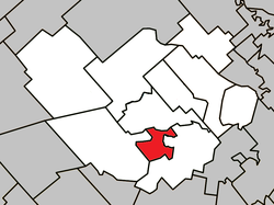 Location within Montcalm RCM. | |
 Saint-Roch-Ouest Location in central Quebec. | |
| Coordinates: 45°51′N 73°39′W[1] | |
| Country | |
| Province | |
| Region | Lanaudière |
| RCM | Montcalm |
| Constituted | June 4, 1921 |
| Government | |
| • Mayor | Claude Mercier |
| • Federal riding | Montcalm |
| • Prov. riding | Rousseau |
| Area | |
| • Total | 20.10 km2 (7.76 sq mi) |
| • Land | 20.78 km2 (8.02 sq mi) |
| There is an apparent contradiction between two authoritative sources | |
| Population (2011)[3] | |
| • Total | 267 |
| • Density | 12.9/km2 (33/sq mi) |
| • Pop 2006–2011 | |
| Time zone | UTC−5 (EST) |
| • Summer (DST) | UTC−4 (EDT) |
| Postal code(s) | J0K 3H0 |
| Area code(s) | 450 and 579 |
| Highways[4] | |
| Website | www |
History
Saint-Roch-Ouest was formed in 1921 when it separated from the Parish Municipality of Saint-Roch.[1]
Economy
The relatively rich soils encouraged agricultural activity all throughout its history and Saint-Roch-Ouest has retained agriculture as the most important economic sector. All land of the municipality is occupied by agricultural activity, in particular vegetable production and the cultivation of cereals. Additionally, there are also pork breeders and dairy farms.[5]
Demographics
Population trend:[6]
- Population in 2011: 267 (2006 to 2011 population change: -6.3%)
- Population in 2006: 285
- Population in 2001: 310
- Population in 1996: 350 (or 312 when adjusted to 2001 boundaries)
- Population in 1991: 357
Private dwellings occupied by usual residents: 97 (total dwellings: 102)
Mother tongue:
- English as first language: 0%
- French as first language: 100%
- English and French as first language: 0%
- Other as first language: 0%
Education
This section needs expansion. You can help by adding to it. (September 2017) |
The Sir Wilfrid Laurier School Board operates anglophone public schools, including:
References
- Reference number 57599 of the Commission de toponymie du Québec (in French)
- Geographic code 63040 in the official Répertoire des municipalités (in French)
- Statistics Canada 2011 Census - Saint-Roch-Ouest census profile
- Official Transport Quebec Road Map
- "La municipalité de Saint-Roch-Ouest" (in French). Centre local de développement Montcalm. Archived from the original on 2010-10-30. Retrieved 2009-09-24.
- Statistics Canada: 1996, 2001, 2006, 2011 census
- "JOLIETTE ELEMENTARY ZONE." Sir Wilfrid Laurier School Board. Retrieved on September 17, 2017.
- "Joliette High School Zone Sec 1-5." Sir Wilfrid Laurier School Board. Retrieved on September 5, 2017.
Places adjacent to Saint-Roch-Ouest, Quebec | ||||||||||||||||
|---|---|---|---|---|---|---|---|---|---|---|---|---|---|---|---|---|
| ||||||||||||||||
| Cities/towns |
|
|---|---|
| Municipalities |
|
| |
| Authority control |
|
|---|
Другой контент может иметь иную лицензию. Перед использованием материалов сайта WikiSort.org внимательно изучите правила лицензирования конкретных элементов наполнения сайта.
WikiSort.org - проект по пересортировке и дополнению контента Википедии