world.wikisort.org - Canada
North Lake is a civil parish in York County, New Brunswick, Canada.[2]
North Lake | |
|---|---|
Parish | |
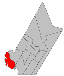 Location within York County, New Brunswick. | |
| Coordinates: 45.8275°N 67.73°W | |
| Country | |
| Province | |
| County | York |
| Erected | 1879 |
| Area | |
| • Land | 439.60 km2 (169.73 sq mi) |
| Population (2021)[1] | |
| • Total | 282 |
| • Density | 0.6/km2 (2/sq mi) |
| • Change 2016-2021 | |
| • Dwellings | 383 |
| Time zone | UTC-4 (AST) |
| • Summer (DST) | UTC-3 (ADT) |
For governance purposes it forms the local service district of the parish of North Lake,[3] which is a member of the Western Valley Regional Service Commission (WVRSC).[4]
Origin of name
The parish takes its name from the eponymous lake.[5]
History
North Lake was erected in 1879 from Canterbury Parish.[6]
Boundaries
North Lake Parish is bounded:[2][7][8]
- on the north by the Carleton County line;
- on the east by a line running up Eel River, including First Eel Lake, Second Eel Lake, and Third Eel Lake, then east-southeasterly across land to La Coote Lake, then down La Coote Lake and Big La Coote Stream to the northern end of Palfrey Lake;
- on the southeast by a line running southwesterly from the southeastern corner of a grant to Abraham Lint west of Allandale Road near the Saint John River to a point west of Sandy Point on Spednic Lake, paralleling the southeastern lines of other parishes south of the Saint John River;
- on the west by the international border, running up Spednic Lake, Grand Lake, the North Lake Thoroughfare, North Lake, and Monument Brook to the Carleton County line.
Communities
Communities at least partly within the parish.[7][8][9]
|
|
Bodies of water
Bodies of water[lower-alpha 1] at least partly within the parish.[7][8][9] italics indicate a name no longer in official use
|
|
Islands
Islands at least partly within the parish.[7][8][9]
- Frog Island
- Pine Island
Other notable places
Parks, historic sites, and other noteworthy places at least partly within the parish.[7][8][9][10]
- First Eel Lake Protected Natural Area
- Hay Brook Protected Natural Area
- Maxwell Protected Natural Area
- Monument Brook Protected Natural Area
- North Lake Protected Natural Area
- Spednic Lake Protected Natural Area
- Tamarack Brook Protected Natural Area
Demographics
Population
|
LanguageMother tongue (2016)[13]
|
See also
- List of parishes in New Brunswick
Notes
- Not including brooks, ponds or coves.
References
- "Census Profile". Statistics Canada. 26 October 2022. Retrieved 30 October 2022.
- "Chapter T-3 Territorial Division Act". Government of New Brunswick. Retrieved 13 November 2020.
- "New Brunswick Regulation 84-168 under the Municipalities Act (O.C. 84-582)". Government of New Brunswick. Retrieved 25 July 2020.
- "Communities in each of the 12 Regional Service Commissions (RSC) / Les communautés dans chacune des 12 Commissions de services régionaux (CSR)" (PDF), Government of New Brunswick, July 2017, retrieved 1 February 2021
- Ganong, William F. (1896). A Monograph of the Place-Nomenclature of the Province of New Brunswick. Royal Society of Canada. p. 258. Retrieved 17 March 2021.
- "42 Vic. c. 42 An Act to erect part of the Parish of Canterbury, in the County of York, into a separate Parish.". Acts of the General Assembly of Her Majesty's Province of New Brunswick. Passed in the Month of April 1879. Fredericton: Government of New Brunswick. 1879. pp. 84–85. Available as a free ebook from Google Books.
- "No. 123". Provincial Archives of New Brunswick. Department of Natural Resources and Energy Development. Retrieved 25 June 2021. Remainder of parish on maps 134, 135, and 145 at same site.
- "365" (PDF). Transportation and Infrastructure. Government of New Brunswick. Retrieved 25 June 2021. Remainder of parish on mapbooks 384, 385, 403–405, 421–423, and 438 at same site.
- "Search the Canadian Geographical Names Database (CGNDB)". Government of Canada. Retrieved 3 July 2021.
- "Explore New Brunswick's Protected Natural Areas". GeoNB. Retrieved 3 July 2021.
- Statistics Canada: 1996, 2001, 2006, 2011 census
- 2011 Statistics Canada Census Profile: North Lake Parish, New Brunswick
- "Census Profile, 2016 Census North Lake, Parish [Census subdivision], New Brunswick". Statistics Canada. Retrieved 7 October 2019.
Places adjacent to North Lake Parish, New Brunswick | ||||||||||||||||
|---|---|---|---|---|---|---|---|---|---|---|---|---|---|---|---|---|
| ||||||||||||||||
Subdivisions of New Brunswick | |
|---|---|
| Subdivisions |
|
| Cities | |
| Counties | |
| |
Текст в блоке "Читать" взят с сайта "Википедия" и доступен по лицензии Creative Commons Attribution-ShareAlike; в отдельных случаях могут действовать дополнительные условия.
Другой контент может иметь иную лицензию. Перед использованием материалов сайта WikiSort.org внимательно изучите правила лицензирования конкретных элементов наполнения сайта.
Другой контент может иметь иную лицензию. Перед использованием материалов сайта WikiSort.org внимательно изучите правила лицензирования конкретных элементов наполнения сайта.
2019-2025
WikiSort.org - проект по пересортировке и дополнению контента Википедии
WikiSort.org - проект по пересортировке и дополнению контента Википедии