world.wikisort.org - Canada
Masinasin is a former community in Alberta, Canada within the County of Warner No. 5. It is located 1 km (0.62 mi) off Highway 501 on Range Road 133, approximately 31 km (19 mi) east of the Town of Milk River and 18 km (11 mi) north of the Canada–US border and Writing-on-Stone Provincial Park. All that remains of the former community is a small alternative school with baseball diamonds and the overgrown Pioneer Cemetery,[1] approximately 3 km (1.9 mi) to the southeast on Highway 500.
This article needs additional citations for verification. (August 2010) |
Masinasin | |
|---|---|
Unincorporated community | |
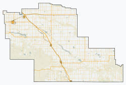 Masinasin Location in County of Warner  Masinasin Location in Alberta | |
| Coordinates: 49°9′8″N 111°40′35″W | |
| Country | Canada |
| Province | Alberta |
| Region | Southern Alberta |
| Planning region | South Saskatchewan |
| Municipal district | Warner |
| Founded | 1890s |
| Government | |
| • Governing body | Warner County Council |
| • MP | Glen Motz |
| • MLA | Grant Hunter |
| Time zone | UTC−7 (MST) |
| • Summer (DST) | UTC−6 (MDT) |
| Postal code span | TOK |
| Area code(s) | +1-403 |
| Highways | Highway 500 Highway 501 |
Masinasin is a Cree name meaning 'Writing on Stone', referring to figures and writing cut in the sandstone banks of Milk River.[citation needed]
Climate
Masinasin experiences a semi-arid, continental climate (Köppen climate classification BSk).[2]
| Climate data for Masinasin, Alberta | |||||||||||||
|---|---|---|---|---|---|---|---|---|---|---|---|---|---|
| Month | Jan | Feb | Mar | Apr | May | Jun | Jul | Aug | Sep | Oct | Nov | Dec | Year |
| Record high °C (°F) | 17 (63) |
24 (75) |
23 (73) |
31.5 (88.7) |
33.5 (92.3) |
37 (99) |
39 (102) |
41 (106) |
37 (99) |
31 (88) |
24 (75) |
17.5 (63.5) |
41 (106) |
| Average high °C (°F) | −0.5 (31.1) |
2.0 (35.6) |
6.7 (44.1) |
13.8 (56.8) |
19.4 (66.9) |
23.4 (74.1) |
28.3 (82.9) |
27.4 (81.3) |
20.8 (69.4) |
13.9 (57.0) |
4.9 (40.8) |
−0.8 (30.6) |
13.3 (55.9) |
| Daily mean °C (°F) | −6.2 (20.8) |
−4.1 (24.6) |
0.4 (32.7) |
6.6 (43.9) |
11.9 (53.4) |
16.0 (60.8) |
19.7 (67.5) |
18.9 (66.0) |
13.2 (55.8) |
7.1 (44.8) |
−0.9 (30.4) |
−6.6 (20.1) |
6.3 (43.3) |
| Average low °C (°F) | −12 (10) |
−10.2 (13.6) |
−5.8 (21.6) |
−0.6 (30.9) |
4.3 (39.7) |
8.6 (47.5) |
11.0 (51.8) |
10.3 (50.5) |
5.6 (42.1) |
0.2 (32.4) |
−6.6 (20.1) |
−12.4 (9.7) |
−0.6 (30.9) |
| Record low °C (°F) | −39 (−38) |
−36.5 (−33.7) |
−35 (−31) |
−18.5 (−1.3) |
−6.5 (20.3) |
−1.5 (29.3) |
2 (36) |
−1.5 (29.3) |
−8 (18) |
−27 (−17) |
−34.5 (−30.1) |
−41 (−42) |
−41 (−42) |
| Average precipitation mm (inches) | 20.1 (0.79) |
16.8 (0.66) |
34.5 (1.36) |
33.6 (1.32) |
52.5 (2.07) |
78.3 (3.08) |
32.0 (1.26) |
37.6 (1.48) |
40.5 (1.59) |
23.3 (0.92) |
19.9 (0.78) |
17.5 (0.69) |
407.3 (16.04) |
| Source: 1981-2010 Environment Canada[3] | |||||||||||||
Education
The Milk River Valley School District No. 2024 was formed on August 24, 1909. The Milk River Valley school was a one room schoolhouse that once stood at township 15 - 2 - 13 - W4.[4] Originally named Milk River Valley, the name was changed to Masinasin in 1941, when several area school districts were centralized and moved to Masinasin.
See also
- List of communities in Alberta
References
- Masinasin Cemetery - Photos
- "Climatic Regions [Köppen]". Natural Resources Canada. Archived from the original on 3 April 2012. Retrieved 5 November 2012.
- Environment Canada—. Retrieved 23 July 2017.
- Milk River Valley/Masinasin S.D. No. 2024 Archived 2011-07-27 at the Wayback Machine - Glenbow Archives
Places adjacent to Masinasin, Alberta | |
|---|---|
Subdivisions of Alberta | |
|---|---|
| Subdivisions |
|
| Communities |
|
| Cities and urban service areas |
|
| |
| Cities |
|
|---|---|
| Towns |
|
| Villages | |
| Hamlets |
|
| Summer villages |
|
| Municipal districts |
|
| Specialized municipalities |
|
| Improvement districts |
|
| Indian reserves |
|
| National parks |
|
| Other topics |
|
| |
Другой контент может иметь иную лицензию. Перед использованием материалов сайта WikiSort.org внимательно изучите правила лицензирования конкретных элементов наполнения сайта.
WikiSort.org - проект по пересортировке и дополнению контента Википедии