world.wikisort.org - Canada
Mactaggart is a neighbourhood in southwest Edmonton, Alberta, Canada that was established in 2005 through the adoption of the Mactaggart Neighbourhood Area Structure Plan (NASP).[8]
Mactaggart | |
|---|---|
Neighbourhood | |
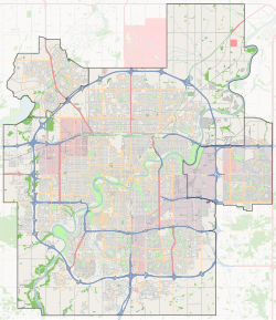  Mactaggart Location of Mactaggart in Edmonton | |
| Coordinates: 53.445°N 113.560°W | |
| Country |  Canada |
| Province |  Alberta |
| City | Edmonton |
| Quadrant[1] | NW |
| Ward[1] | pihêsiwin |
| Sector[2] | Southwest |
| Area[3][4] | Terwillegar Heights |
| Government | |
| • Administrative body | Edmonton City Council |
| • Councillor | Tim Cartmell |
| Area | |
| • Total | 1.04 km2 (0.40 sq mi) |
| Elevation | 691 m (2,267 ft) |
| Population (2012)[7] | |
| • Total | 1,687 |
| • Density | 1,622.1/km2 (4,201/sq mi) |
| • Change (2009–12) |  80.6% |
| • Dwellings | 812 |
Mactaggart is located within Terwillegar Heights that was initially planned under the Terwillegar Heights Servicing Concept Design Brief (SCDB).[9]
It is bounded on the west by Rabbit Hill Road (142 Street), north by the Magrath Heights neighbourhood, east and southeast by the Whitemud Creek ravine, and south by Anthony Henday Drive.[8][9]
Demographics
In the City of Edmonton's 2012 municipal census, Mactaggart had a population of 1,687 living in 812 dwellings,[7] an 80.6% change from its 2009 population of 934.[10] With a land area of 1.04 km2 (0.40 sq mi),[6] it had a population density of 1,622.1 people/km2 in 2012.[6][7]
Surrounding neighbourhoods
Places adjacent to Mactaggart, Edmonton | ||||||||||||||||
|---|---|---|---|---|---|---|---|---|---|---|---|---|---|---|---|---|
| ||||||||||||||||


References
- "City of Edmonton Wards & Standard Neighbourhoods" (PDF). City of Edmonton. Archived from the original (PDF) on May 3, 2014. Retrieved February 13, 2013.
- "Edmonton Developing and Planned Neighbourhoods, 2011" (PDF). City of Edmonton. Archived from the original (PDF) on September 4, 2013. Retrieved February 13, 2013.
- "The Way We Grow: Municipal Development Plan Bylaw 15100" (PDF). City of Edmonton. 2010-05-26. Archived from the original (PDF) on May 2, 2015. Retrieved February 13, 2013.
- "City of Edmonton Plans in Effect" (PDF). City of Edmonton. November 2011. Archived from the original (PDF) on October 17, 2013. Retrieved February 13, 2013.
- "City Councillors". City of Edmonton. Retrieved February 13, 2013.
- "Neighbourhoods (data plus kml file)". City of Edmonton. Retrieved February 13, 2013.
- "Municipal Census Results – Edmonton 2012 Census". City of Edmonton. Retrieved February 22, 2013.
- "Mactaggart Neighbourhood Area Structure Plan" (PDF). City of Edmonton. April 2006. Archived from the original (PDF) on 2011-06-16. Retrieved 2010-06-10.
- "Terwillegar Heights Servicing Concept Design Brief (SCDB)" (PDF). City of Edmonton. December 2006. Archived from the original (PDF) on 2011-06-16. Retrieved 2010-06-10.
- "2009 Municipal Census Results". City of Edmonton. Retrieved February 22, 2013.
 | This Edmonton Metropolitan Region location article is a stub. You can help Wikipedia by expanding it. |
Другой контент может иметь иную лицензию. Перед использованием материалов сайта WikiSort.org внимательно изучите правила лицензирования конкретных элементов наполнения сайта.
WikiSort.org - проект по пересортировке и дополнению контента Википедии