world.wikisort.org - Canada
Lac-Boulé is an unorganized territory in the Mauricie region of Quebec, Canada, part of the Mékinac Regional County Municipality.
Lac-Boulé | |
|---|---|
Unorganized territory | |
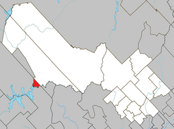 Location within Mékinac RCM. | |
 Lac-Boulé Location in central Quebec. | |
| Coordinates: 46°53′N 73°37′W[1] | |
| Country | |
| Province | |
| Region | Mauricie |
| RCM | Mékinac |
| Constituted | March 13, 1986 |
| Government | |
| • Federal riding | Saint-Maurice—Champlain |
| • Prov. riding | Laviolette |
| Area | |
| • Total | 24.40 km2 (9.42 sq mi) |
| • Land | 22.96 km2 (8.86 sq mi) |
| Population (2011)[3] | |
| • Total | 0 |
| • Density | 0.0/km2 (0/sq mi) |
| • Pop 2006-2011 | |
| • Dwellings | 0 |
| Time zone | UTC−5 (EST) |
| • Summer (DST) | UTC−4 (EDT) |
| Highways | No major routes |
References
- "Reference number 149695 in Banque de noms de lieux du Québec". toponymie.gouv.qc.ca (in French). Commission de toponymie du Québec.
- Ministère des Affaires municipales, des Régions et de l'Occupation du territoire - Répertoire des municipalités: Lac-Boulé
- Statistics Canada 2011 Census - Lac-Boulé census profile
Adjacent Municipal Subdivisions | ||||||||||||||||
|---|---|---|---|---|---|---|---|---|---|---|---|---|---|---|---|---|
| ||||||||||||||||
| Cities & towns |
|
|---|---|
| Municipalities |
|
| Parishes |
|
| Villages |
|
| Unorganized territories |
|
| |
This Quebec location article is a stub. You can help Wikipedia by expanding it. |
Текст в блоке "Читать" взят с сайта "Википедия" и доступен по лицензии Creative Commons Attribution-ShareAlike; в отдельных случаях могут действовать дополнительные условия.
Другой контент может иметь иную лицензию. Перед использованием материалов сайта WikiSort.org внимательно изучите правила лицензирования конкретных элементов наполнения сайта.
Другой контент может иметь иную лицензию. Перед использованием материалов сайта WikiSort.org внимательно изучите правила лицензирования конкретных элементов наполнения сайта.
2019-2026
WikiSort.org - проект по пересортировке и дополнению контента Википедии
WikiSort.org - проект по пересортировке и дополнению контента Википедии