world.wikisort.org - Canada
Huberdeau is a village and municipality in the Laurentides region of Quebec, Canada, part of the Les Laurentides Regional County Municipality. It is located along the western banks of the Rouge River.
Huberdeau | |
|---|---|
Municipality | |
 | |
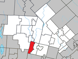 Location within Les Laurentides RCM | |
 Huberdeau Location in central Quebec | |
| Coordinates: 45°58′N 74°38′W[1] | |
| Country | |
| Province | |
| Region | Laurentides |
| RCM | Les Laurentides |
| Constituted | June 8, 1926 |
| Government | |
| • Mayor | Évelyne Charbonneau |
| • Federal riding | Laurentides—Labelle |
| • Prov. riding | Labelle |
| Area | |
| • Total | 59.50 km2 (22.97 sq mi) |
| • Land | 56.73 km2 (21.90 sq mi) |
| Population (2011)[3] | |
| • Total | 894 |
| • Density | 15.8/km2 (41/sq mi) |
| • Pop 2006-2011 | |
| • Dwellings | 531 |
| Time zone | UTC−5 (EST) |
| • Summer (DST) | UTC−4 (EDT) |
| Postal code(s) | J0T 1G0 |
| Area code(s) | 819 |
| Highways | |
Demographics
Population trend:[4]
- Population in 2011: 894 (2006 to 2011 population change: -3.2%)
- Population in 2006: 924
- Population in 2001: 918
- Population in 1996: 942
- Population in 1991: 903
Private dwellings occupied by usual residents: 409 (total dwellings: 531)
Mother tongue:
- English as first language: 6.4%
- French as first language: 89.5%
- English and French as first language: 1.2%
- Other as first language: 2.9%

Education
This section needs expansion. You can help by adding to it. (September 2017) |
Sir Wilfrid Laurier School Board operates English-language schools:
- Arundel Elementary School in Arundel[5]
- Sainte Agathe Academy (for high school only) in Sainte-Agathe-des-Monts[6]
References
- Reference number 29158 of the Commission de toponymie du Québec (in French)
- Geographic code 78065 in the official Répertoire des municipalités (in French)
- "(Code 2478065) Census Profile". 2011 census. Statistics Canada. 2012.
- Statistics Canada: 1996, 2001, 2006, 2011 census
- "Arundel Elementary Zone." Sir Wilfrid Laurier School Board. Retrieved on September 16, 2017.
- "SAINTE AGATHE HIGH SCOOL ZONE" [sic]. Sir Wilfrid Laurier School Board. Retrieved on September 17, 2017 - See text description of boundaries in: About Us" as well as the Elementary zone map - Note that all areas covered in the elementary map are also covered in the secondary one.
| Wikimedia Commons has media related to Huberdeau. |
Places adjacent to Huberdeau, Quebec | ||||||||||||||||
|---|---|---|---|---|---|---|---|---|---|---|---|---|---|---|---|---|
| ||||||||||||||||
| Cities/towns |
|
|---|---|
| Municipalities | |
| Townships |
|
| Parishes |
|
| Villages |
|
| |
Authority control | |
|---|---|
| General |
|
| National libraries | |
This Quebec location article is a stub. You can help Wikipedia by expanding it. |
Текст в блоке "Читать" взят с сайта "Википедия" и доступен по лицензии Creative Commons Attribution-ShareAlike; в отдельных случаях могут действовать дополнительные условия.
Другой контент может иметь иную лицензию. Перед использованием материалов сайта WikiSort.org внимательно изучите правила лицензирования конкретных элементов наполнения сайта.
Другой контент может иметь иную лицензию. Перед использованием материалов сайта WikiSort.org внимательно изучите правила лицензирования конкретных элементов наполнения сайта.
2019-2026
WikiSort.org - проект по пересортировке и дополнению контента Википедии
WikiSort.org - проект по пересортировке и дополнению контента Википедии