world.wikisort.org - Canada
Cook's Harbour is a town in the Canadian province of Newfoundland and Labrador. The town had a population of 123 in the Canada 2016 Census.[2]
Cook's Harbour | |
|---|---|
Town | |
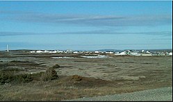
 View of Cook's Harbour | |
| Coordinates: 51°36′12″N 55°52′16″W | |
| Country | |
| Province | |
| Area | |
| • Land | 1.95 km2 (0.75 sq mi) |
| Population (2021)[1] | |
| • Total | 118 |
| • Density | 62.9/km2 (163/sq mi) |
| Time zone | UTC-3:30 (Newfoundland Time) |
| • Summer (DST) | UTC-2:30 (Newfoundland Daylight) |
| Area code(s) | 709 |
| Highways | |
History
Cook's Harbour was named by Captain James Cook in 1764, during his survey of Newfoundland.[3]
Demographics
In the 2021 Census of Population conducted by Statistics Canada, Cook's Harbour had a population of 118 living in 67 of its 92 total private dwellings, a change of -4.1% from its 2016 population of 123. With a land area of 1.94 km2 (0.75 sq mi), it had a population density of 60.8/km2 (157.5/sq mi) in 2021.[1]
References
- "Population and dwelling counts: Canada, provinces and territories, census divisions and census subdivisions (municipalities), Newfoundland and Labrador". Statistics Canada. February 9, 2022. Retrieved March 15, 2022.
- "Census Profile, 2016 Census". Statistics Canada. February 14, 2017. Retrieved February 15, 2017.
- "Cook's Harbour". Land of First Contact. 2014. Archived from the original on 2014-10-15. Retrieved 2014-10-10.
Текст в блоке "Читать" взят с сайта "Википедия" и доступен по лицензии Creative Commons Attribution-ShareAlike; в отдельных случаях могут действовать дополнительные условия.
Другой контент может иметь иную лицензию. Перед использованием материалов сайта WikiSort.org внимательно изучите правила лицензирования конкретных элементов наполнения сайта.
Другой контент может иметь иную лицензию. Перед использованием материалов сайта WikiSort.org внимательно изучите правила лицензирования конкретных элементов наполнения сайта.
2019-2025
WikiSort.org - проект по пересортировке и дополнению контента Википедии
WikiSort.org - проект по пересортировке и дополнению контента Википедии


