world.wikisort.org - Canada
Coleman is a community in the Rocky Mountains within the Municipality of Crowsnest Pass in southwest Alberta, Canada. It was formerly incorporated as a town prior to 1979 when it amalgamated with four other municipalities to form Crowsnest Pass.
Coleman | |
|---|---|
Unincorporated community | |
 | |
 Coleman  Coleman | |
| Coordinates: 49.635°N 114.503°W | |
| Country | Canada |
| Province | Alberta |
| Specialized municipality | Municipality of Crowsnest Pass |
| Village | January 11, 1904[1] |
| Town | September 10, 1910[2] |
| Amalgamated | January 1, 1979[3] |
| Government | |
| • Type | Unincorporated |
| • Governing body | Municipality of Crowsnest Pass Council |
| Area | |
| • Land | 1.99 km2 (0.77 sq mi) |
| Elevation | 1,320 m (4,330 ft) |
| Population (2021)[5] | |
| • Total | 1,441 |
| • Density | 724.1/km2 (1,875/sq mi) |
| Time zone | UTC−7 (MST) |
| • Summer (DST) | UTC−6 (MDT) |
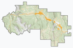
Coleman is located in Census Division No. 15 and in the riding of Macleod. It is served by Highway 3 (Crowsnest Highway) and the Canadian Pacific Railway.
History
In 1903, a new townsite was laid out a few kilometres west of Blairmore, to service a new coal mine operated by the International Coal and Coke Company. Initial names of Paulson's Camp or McGillivray Hill were rejected by the post office, settling on Coleman (after the mother's maiden name of the president and mine owner A. C. Flumerfelt's wife, Ada, and the middle name of his youngest daughter, Norma Coleman Flumerfelt).[6] Coleman was incorporated as a village on January 11, 1904.[1] It then incorporated as a town on September 10, 1910.[2]
A feature of Coleman was the mine's 100 (later 216) coke ovens located at it outskirts, which operated from 1906 to 1952. The town grew rapidly, surpassing its neighbour Blairmore as the largest in the region. Coleman had an opera house from 1908 until it burned down in 1948.
Coleman persevered through strikes (1911 and 1932), floods (1923 and 1942), and fires (1948). As the coal mines in the region gradually closed, Coleman's commercial importance waned in favour of Blairmore. On November 3, 1978, the Government of Alberta passed the Crowsnest Pass Municipal Unification Act, which led to the formal amalgamation of the Town of Coleman with the Village of Bellevue, the Town of Blairmore, the Village of Frank, and Improvement District (ID) No. 5 on January 1, 1979.[3]
Coleman's coal mining heritage is evident in its several historic buildings, a regional museum, the ruins of its coal plant and coke ovens, several nearby abandoned mines, and the "biggest piggy bank in the world" made from a 36-inch (910 mm) gauge air driven thermos bottle mine locomotive. Much of the downtown section now forms the Coleman National Historic Site.[7]
Geography
Climate
Coleman has a subarctic climate (Dfc) with mild to warm summers and cold, snowy winters.
| Climate data for Coleman | |||||||||||||
|---|---|---|---|---|---|---|---|---|---|---|---|---|---|
| Month | Jan | Feb | Mar | Apr | May | Jun | Jul | Aug | Sep | Oct | Nov | Dec | Year |
| Record high °C (°F) | 11.5 (52.7) |
13.9 (57.0) |
18.3 (64.9) |
25.6 (78.1) |
29.0 (84.2) |
30.0 (86.0) |
35.0 (95.0) |
34.0 (93.2) |
32.0 (89.6) |
26.0 (78.8) |
16.0 (60.8) |
13.5 (56.3) |
35.0 (95.0) |
| Average high °C (°F) | −1.6 (29.1) |
0.1 (32.2) |
4.6 (40.3) |
9.5 (49.1) |
14.4 (57.9) |
18.7 (65.7) |
22.1 (71.8) |
22.8 (73.0) |
17.0 (62.6) |
10.2 (50.4) |
1.4 (34.5) |
−3.0 (26.6) |
9.7 (49.5) |
| Daily mean °C (°F) | −6.4 (20.5) |
−5.0 (23.0) |
−0.8 (30.6) |
3.6 (38.5) |
7.9 (46.2) |
11.8 (53.2) |
14.3 (57.7) |
14.3 (57.7) |
9.5 (49.1) |
4.6 (40.3) |
−2.7 (27.1) |
−7.4 (18.7) |
3.6 (38.5) |
| Average low °C (°F) | −11.3 (11.7) |
−10.1 (13.8) |
−6.2 (20.8) |
−2.4 (27.7) |
1.3 (34.3) |
4.9 (40.8) |
6.5 (43.7) |
5.7 (42.3) |
2.0 (35.6) |
−1.1 (30.0) |
−6.8 (19.8) |
−11.9 (10.6) |
−2.4 (27.7) |
| Record low °C (°F) | −39.4 (−38.9) |
−37.5 (−35.5) |
−37.2 (−35.0) |
−24.4 (−11.9) |
−8.3 (17.1) |
−5.6 (21.9) |
−3.3 (26.1) |
−7.0 (19.4) |
−11.0 (12.2) |
−27.0 (−16.6) |
−37.0 (−34.6) |
−41.1 (−42.0) |
−41.1 (−42.0) |
| Average precipitation mm (inches) | 34.8 (1.37) |
37.1 (1.46) |
38.6 (1.52) |
39.8 (1.57) |
69.6 (2.74) |
70.2 (2.76) |
62.6 (2.46) |
43.7 (1.72) |
45.9 (1.81) |
46.4 (1.83) |
56.2 (2.21) |
37.3 (1.47) |
582.1 (22.92) |
| Average rainfall mm (inches) | 12.7 (0.50) |
10.8 (0.43) |
13.0 (0.51) |
23.0 (0.91) |
60.8 (2.39) |
70.2 (2.76) |
62.6 (2.46) |
43.2 (1.70) |
44.3 (1.74) |
32.8 (1.29) |
22.4 (0.88) |
9.2 (0.36) |
404.8 (15.94) |
| Average snowfall cm (inches) | 22.1 (8.7) |
26.4 (10.4) |
25.6 (10.1) |
16.7 (6.6) |
8.8 (3.5) |
0.0 (0.0) |
0.0 (0.0) |
0.5 (0.2) |
1.7 (0.7) |
13.6 (5.4) |
33.9 (13.3) |
28.1 (11.1) |
177.3 (69.8) |
| Source: Environment Canada[8] | |||||||||||||
Demographics
|
|
| |||||||||||||||||||||||||||||||||||||||||||||||||||||||||||||||
| Source: Statistics Canada[9][10][11][12][13][14][15][5] | |||||||||||||||||||||||||||||||||||||||||||||||||||||||||||||||||
In the 2021 Census of Population, the urban population centre of Coleman, as delineated by Statistics Canada, recorded a population of 1,441 living in 722 of its 907 total private dwellings, a change of -2.3% from its 2016 population of 1,475. With a land area of 1.99 km2 (0.77 sq mi), it had a population density of 724.1/km2 (1,875.5/sq mi) in 2021.[5]
As a population centre in the 2016 Census of Population conducted by Statistics Canada, Coleman recorded a population of 1,475 living in 696 of its 891 total private dwellings, an 8% change from its 2011 population of 1,366. With a land area of 1.97 km2 (0.76 sq mi), it had a population density of 748.7/km2 (1,939.2/sq mi) in 2016.[15]
Notable people
- Joe Kryczka, Justice of the Court of Queen's Bench of Alberta, president of the Canadian Amateur Hockey Association
See also
- List of former urban municipalities in Alberta
References
![]() Media related to Coleman, Alberta at Wikimedia Commons
Media related to Coleman, Alberta at Wikimedia Commons
- North-West Territories Gazette. Government of the North-West Territories. 20 January 1901. p. 12.
- Alberta Gazette. Vol. 6. Government of Alberta. 15 September 1910. p. 448.
- "Location and History Profile – Municipality of Crowsnest Pass" (PDF). Alberta Municipal Affairs. 15 October 2021. Retrieved 20 October 2021.
- "Alberta Private Sewage Systems 2009 Standard of Practice Handbook: Appendix A.3 Alberta Design Data (A.3.A. Alberta Climate Design Data by Town)" (PDF) (PDF). Safety Codes Council. January 2012. pp. 212–215 (PDF pages 226–229). Archived from the original (PDF) on 16 October 2013. Retrieved 8 October 2013.
- "Population and dwelling counts: Canada and population centres". Statistics Canada. 9 February 2022. Retrieved 10 February 2022.
- Coleman Board of Trade (1953). Coleman's 50th Anniversary Booklet. Lethbridge: Lethbridge Herald. p. 17. Archived from the original on 24 September 2015.
- "Discover Crowsnest Heritage » Coleman National Historic Site". www.crowsnestheritage.ca. Retrieved 24 September 2018.
- "Coleman, Alberta". Canadian Climate Normals 1981–2010 (in English and French). Environment Canada. Retrieved 12 March 2014.
- "Table 1: Population by sexes in 1906 and 1901". 1906 Census: Northwest Provinces (Manitoba Saskatchewan Alberta). Vol. I: Population of 1906 Compared with 1901. Ottawa: Dominion Bureau of Statistics. 1907. pp. 55–78. Retrieved 24 October 2021.
- "Table 5: Population of urban centres, 1916-1946, with guide to locations". 1946 Census of Alberta (PDF). Vol. Population. Ottawa: Dominion Bureau of Statistics. 22 August 1949. pp. 397–400. Retrieved 24 October 2021.
- "Table 6: Population by census subdivisions, 1901–1961". 1961 Census of Canada. Series 1.1: Historical, 1901–1961. Vol. I: Population. Ottawa: Dominion Bureau of Statistics. 8 March 1963. p. 6.77–6.83. Retrieved 24 October 2021.
- "Table 10: Population of incorporated cities, towns and villages, 1966 and 1961, with guide to locations". 1961 Census of Canada. Vol. Population: Incorporated Cities, Towns and Villages. Ottawa: Dominion Bureau of Statistics. October 1967. pp. 10–1 to 10–32. Retrieved 24 October 2021.
- "Table 2: Area and Density of Population, for Census Subdivisions Population by census subdivisions, 1971 (Alberta)". 1971 Census of Canada. Special Bulletin: Geography. Vol. Land Areas and Densities of Statistical Units. Ottawa: Statistics Canada. June 1973. pp. 2–41 to 2–44. Retrieved 24 October 2021.[permanent dead link]
- Population: Geographic Distributions – Census Divisions and Subdivisions, Western Provinces and the Territories. Statistics Canada. June 1977. pp. 3–41.
- "Population and dwelling counts, for Canada, provinces and territories, and population centres, 2016 and 2011 censuses – 100% data (Alberta)". Statistics Canada. 7 February 2018. Retrieved 26 October 2021.
Authority control | |
|---|---|
| General | |
| National libraries | |
| Other |
|
Другой контент может иметь иную лицензию. Перед использованием материалов сайта WikiSort.org внимательно изучите правила лицензирования конкретных элементов наполнения сайта.
WikiSort.org - проект по пересортировке и дополнению контента Википедии