world.wikisort.org - Kanada
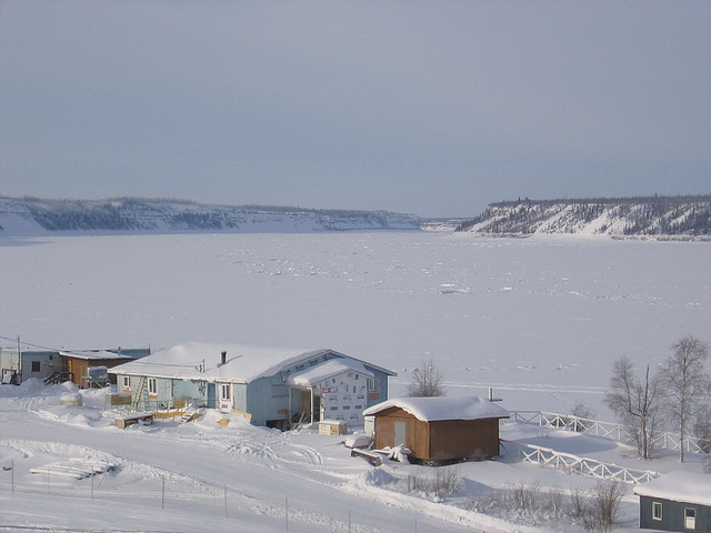
Fort Good Hope, Bezirk Sahtu, Nordwest-Territorien, Kanada, ist eine von 516 Menschen (Stand 2016) bewohnte Siedlung.
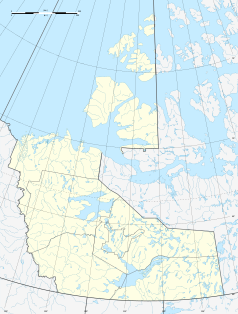
| Fort Good Hope | |||
|---|---|---|---|
| Lage in Kanada | |||
| |||
| Staat: | |||
| Territorium: | Nordwest-Territorien | ||
| Region: | Sahtu | ||
| Koordinaten: | 62° 50′ N, 116° 4′ W | ||
| Einwohner: | 516 (Stand: 2016[1]) | ||
 Fort Good Hope und Mackenziefluss | |||
Lage
Ford Good Hope liegt am 1903 km langen Mackenziefluss, der sich, vom Großen Sklavensee kommend, in das Arktische Eismeer ergießt.[2] Der schwer erreichbare Ort verfügt über einen Landeplatz und wird regelmäßig von den Fluglinien Canadian North und Buffalo Airways angeflogen.
Sonstiges
- Kurz vor Weihnachten 2009 brannte der Dorfladen "Northern store" ab.[3]
Einwohnerentwicklung
| Jahr | Einwohnerzahl[4] | Veränderung in % |
|---|---|---|
| 1996 | 699 | – |
| 1997 | 687 | −1,7 % |
| 1998 | 674 | −1,9 % |
| 1999 | 642 | −4,7 % |
| 2000 | 607 | −5,5 % |
| 2001 | 586 | −3,5 % |
| 2002 | 596 | 1,7 % |
| 2003 | 566 | −5,0 % |
| 2004 | 553 | −2,3 % |
| 2005 | 558 | 0,9 % |
| 2006 | 576 | 3,2 % |
| 2007 | 575 | −0,2 % |
| 2008 | 564 | −1,9 % |
| 2009 | 567 | 0,5 % |
Weblinks
Commons: Fort Good Hope – Sammlung von Bildern, Videos und Audiodateien
- Fort Good Hope bei der Legislative Assembly of the NWT (englisch)
Einzelnachweise
- Statistics Canada: Population and dwelling counts, for Northwest Territories and census subdivisions (municipalities), 2016 and 2011 censuses, abgerufen am 2. Mai 2021
- Luftaufnahme (Memento des Originals vom 15. April 2006 im Internet Archive) Info: Der Archivlink wurde automatisch eingesetzt und noch nicht geprüft. Bitte prüfe Original- und Archivlink gemäß Anleitung und entferne dann diesen Hinweis.
- http://www.cbc.ca/news/canada/north/story/2009/12/15/fgh-northern-store-fire.html fgh-northern-store-fire
- Fort Good Hope - Statistical Profile (Memento vom 30. September 2011 im Internet Archive)
На других языках
- [de] Fort Good Hope
[en] Fort Good Hope
Fort Good Hope (formerly Fort Hope, Fort Charles, also now known as the Charter Community of K'asho Got'ine[pronunciation?]), is a charter community in the Sahtu Region of the Northwest Territories, Canada. It is located on a peninsula between Jackfish Creek and the east bank of the Mackenzie River, about 145 km (90 mi) northwest of Norman Wells. The two principal languages are North Slavey and English. Hunting and trapping are two major sources of income. The Church of Our Lady of Good Hope, a National Historic Site, is located in the community. The church, completed in 1885, was once home to Father Émile Petitot.[ru] Форт-Гуд-Хоп
Форт-Гуд-Хоп[1] (англ. Fort Good Hope) — деревня в Северо-Западных территориях, Канада.Текст в блоке "Читать" взят с сайта "Википедия" и доступен по лицензии Creative Commons Attribution-ShareAlike; в отдельных случаях могут действовать дополнительные условия.
Другой контент может иметь иную лицензию. Перед использованием материалов сайта WikiSort.org внимательно изучите правила лицензирования конкретных элементов наполнения сайта.
Другой контент может иметь иную лицензию. Перед использованием материалов сайта WikiSort.org внимательно изучите правила лицензирования конкретных элементов наполнения сайта.
2019-2026
WikiSort.org - проект по пересортировке и дополнению контента Википедии
WikiSort.org - проект по пересортировке и дополнению контента Википедии