world.wikisort.org - Brasile
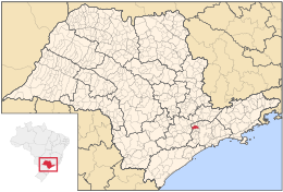
Santana de Parnaíba è un comune del Brasile nello Stato di San Paolo, parte della mesoregione Metropolitana de São Paulo e della microregione di Osasco.
| Santana de Parnaíba comune | |||
|---|---|---|---|
| |||
 | |||
| Localizzazione | |||
| Stato | |||
| Stato federato | |||
| Mesoregione | San Paolo | ||
| Microregione | Osasco | ||
| Amministrazione | |||
| Sindaco | Elvis Leonado Cezar | ||
| Territorio | |||
| Coordinate | 23°26′40″S 46°55′31″W | ||
| Altitudine | 711 m s.l.m. | ||
| Superficie | 179,949 km² | ||
| Abitanti | 108 813[1] (2010) | ||
| Densità | 604,69 ab./km² | ||
| Altre informazioni | |||
| Prefisso | 11 | ||
| Fuso orario | UTC-3 | ||
| Codice IBGE | 3547304 | ||
| Nome abitanti | parnaibano | ||
| Cartografia | |||
 Santana de Parnaíba | |||
 | |||
| Sito istituzionale | |||


Note
- (PT) Scheda del comune dall'IBGE - Censimento 2010, su cod.ibge.gov.br. URL consultato l'11 settembre 2015.
Altri progetti
 Wikimedia Commons contiene immagini o altri file su Santana de Parnaíba
Collegamenti esterni
- Sito ufficiale, su santanadeparnaiba.sp.gov.br.
| Controllo di autorità | VIAF (EN) 125623903 · LCCN (EN) n91049677 · BNF (FR) cb12184908g (data) |
|---|
На других языках
[en] Santana de Parnaíba
Santana de Parnaíba is a city and municipality in the state of São Paulo in Brazil. It is part of the Metropolitan Region of São Paulo.[3] The population is 142,301 (2020 est.) in an area of 179.95 km2 (69.48 sq mi).[4] It was founded in 1625 near the Tietê River by Susana Dias, an important Bandeirante (Brazilian pioneers) wife. It was the birthplace of prominent Bandeirante Domingos Jorge Velho.[fr] Santana de Parnaíba
Santana de Parnaíba est une ville de l'État de São Paulo au Brésil fondée en 1625. La deuxième partie du nom est constitué d'un mot indien. Datant de plus de 150 ans, la plus vieille boulangerie de São Paulo et de son arrondissement se situe justement à Santana de Parnaíba[2]. Le riche lieu-dit de Alphaville est établi sur une partie de Barueri et de Santana de Parnaíba.- [it] Santana de Parnaíba
[ru] Сантана-ди-Парнаиба
Сантана-ди-Парнаиба (порт. Santana de Parnaíba) — муниципалитет в Бразилии, входит в штат Сан-Паулу. Составная часть мезорегиона Агломерация Сан-Паулу. Находится в составе крупной городской агломерации Агломерация Сан-Паулу. Входит в экономико-статистический микрорегион Озаску. Население составляет 102 224 человека на 2006 год. Занимает площадь 183,816 км². Плотность населения — 556,1 чел./км².Текст в блоке "Читать" взят с сайта "Википедия" и доступен по лицензии Creative Commons Attribution-ShareAlike; в отдельных случаях могут действовать дополнительные условия.
Другой контент может иметь иную лицензию. Перед использованием материалов сайта WikiSort.org внимательно изучите правила лицензирования конкретных элементов наполнения сайта.
Другой контент может иметь иную лицензию. Перед использованием материалов сайта WikiSort.org внимательно изучите правила лицензирования конкретных элементов наполнения сайта.
2019-2026
WikiSort.org - проект по пересортировке и дополнению контента Википедии
WikiSort.org - проект по пересортировке и дополнению контента Википедии