world.wikisort.org - Brasile
Itarantim è un comune del Brasile nello Stato di Bahia, parte della mesoregione del Centro-Sul Baiano e della microregione di Itapetinga.
| Itarantim comune | ||
|---|---|---|
| ||
| Localizzazione | ||
| Stato | ||
| Stato federato | ||
| Mesoregione | Centro-Sul Baiano | |
| Microregione | Itapetinga | |
| Amministrazione | ||
| Sindaco | Paulo Fernandes Souto | |
| Territorio | ||
| Coordinate | 15°39′16″S 40°03′36″W | |
| Altitudine | 263 m s.l.m. | |
| Superficie | 1 805,126 km² | |
| Abitanti | 18 539[1] (2010) | |
| Densità | 10,27 ab./km² | |
| Altre informazioni | ||
| Prefisso | 73 | |
| Fuso orario | UTC-3 | |
| Codice IBGE | 2916807 | |
| Nome abitanti | itarantinense | |
| Cartografia | ||
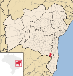
 Itarantim | ||
 | ||

Note
- (PT) Scheda del comune dall'IBGE - Censimento 2010, su cidades.ibge.gov.br. URL consultato il 26 ottobre 2013.
Altri progetti
 Wikimedia Commons contiene immagini o altri file su Itarantim
На других языках
[en] Itarantim
Itarantim is a municipality in the state of Bahia in the North-East region of Brazil.[2][3][4][5][fr] Itarantim
Itarantim est une municipalité brésilienne de l'État de Bahia et la Microrégion d'Itapetinga.- [it] Itarantim
[ru] Итарантин
Итарантин (порт. Itarantim) — муниципалитет в Бразилии, входит в штат Баия. Составная часть мезорегиона Юго-центральная часть штата Баия. Входит в экономико-статистический микрорегион Итапетинга. Население составляет 16 709 человек на 2006 год. Занимает площадь 1 783,747 км². Плотность населения — 9,4 чел./км².Текст в блоке "Читать" взят с сайта "Википедия" и доступен по лицензии Creative Commons Attribution-ShareAlike; в отдельных случаях могут действовать дополнительные условия.
Другой контент может иметь иную лицензию. Перед использованием материалов сайта WikiSort.org внимательно изучите правила лицензирования конкретных элементов наполнения сайта.
Другой контент может иметь иную лицензию. Перед использованием материалов сайта WikiSort.org внимательно изучите правила лицензирования конкретных элементов наполнения сайта.
2019-2025
WikiSort.org - проект по пересортировке и дополнению контента Википедии
WikiSort.org - проект по пересортировке и дополнению контента Википедии