world.wikisort.org - Brasile
Igrejinha è un comune del Brasile nello Stato del Rio Grande do Sul, parte della mesoregione Metropolitana de Porto Alegre e della microregione di Gramado-Canela.

| Igrejinha comune | |||
|---|---|---|---|
| |||
 | |||
| Localizzazione | |||
| Stato | |||
| Stato federato | |||
| Mesoregione | Porto Alegre | ||
| Microregione | Gramado-Canela | ||
| Amministrazione | |||
| Sindaco | Joel Leandro Wilhelm | ||
| Territorio | |||
| Coordinate | 29°34′23″S 50°47′31″W | ||
| Altitudine | 18 e 371 m s.l.m. | ||
| Superficie | 135,861 km² | ||
| Abitanti | 31 660[1] (2010) | ||
| Densità | 233,03 ab./km² | ||
| Altre informazioni | |||
| Cod. postale | 95650-000 | ||
| Prefisso | 51 | ||
| Fuso orario | UTC-3 | ||
| Codice IBGE | 4310108 | ||
| Nome abitanti | igrejinhense | ||
| Cartografia | |||
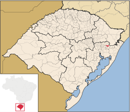
 Igrejinha | |||
 | |||
| Sito istituzionale | |||


Divenne comune autonomo il 1º giugno 1964 per distacco da quello di Taquara.
L'attrazione principale della città, grazie anche alla forte presenza di cittadini di origine tedesca, è la Oktoberfest che si svolge dal 1988, una delle tante feste omonime che si effettuano nel mondo sulla falsariga della Oktoberfest originale tedesca.
L'economia cittadina è basata principalmente sull'industria calzaturiera
Espansione demografica

Note
- (PT) Scheda del comune dall'IBGE - Censimento 2010, su cod.ibge.gov.br. URL consultato il 23 maggio 2015.
Altri progetti
 Wikimedia Commons contiene immagini o altri file su Igrejinha
Collegamenti esterni
- Sito ufficiale, su igrejinha.rs.gov.br.
На других языках
[de] Igrejinha
Igrejinha, amtlich portugiesisch Município de Igrejinha, ist eine Stadt im brasilianischen Bundesstaat Rio Grande do Sul. Sie liegt auf 18 Meter über dem Meeresspiegel und zählte 31.660 Einwohner (2010).[1] Igrejinha erstreckt sich über 136,816 km².[en] Igrejinha
Igrejinha (Portuguese pronunciation: [igɾe'ʒiɲɐ] — little church in Portuguese) is a municipality located in the metropolitan area of Porto Alegre, in the state of Rio Grande do Sul, Brazil. Home to the Morro Alto da Pedra and the regional park Parque Alto da Pedra.[3] The city has approximately 37,000 inhabitants and sits about 82 km (about 51 miles) from the capital city of the state, Porto Alegre.[fr] Igrejinha
Igrejinha est une ville brésilienne de la mésorégion métropolitaine de Porto Alegre, capitale de l'État du Rio Grande do Sul, faisant partie de la microrégion de Gramado-Canela et située à 115 km au nord-est de Porto Alegre. Elle se situe à une latitude de 26° 04′ 01″ sud et à une longitude de 52° 46′ 01″ ouest, à 773 m d'altitude. Sa population était estimée à 31 113 en 2007, pour une superficie de 137 km2. L'accès s'y fait par la RS-115.- [it] Igrejinha
[ru] Игрежинья
Игрежинья (порт. Igrejinha) — муниципалитет в Бразилии, входит в штат Риу-Гранди-ду-Сул. Составная часть мезорегиона Агломерация Порту-Алегри. Входит в экономико-статистический микрорегион Грамаду-Канела. Население составляет 31 389 человек на 2006 год. Занимает площадь 136,816 км². Плотность населения — 229,4 чел./км².Текст в блоке "Читать" взят с сайта "Википедия" и доступен по лицензии Creative Commons Attribution-ShareAlike; в отдельных случаях могут действовать дополнительные условия.
Другой контент может иметь иную лицензию. Перед использованием материалов сайта WikiSort.org внимательно изучите правила лицензирования конкретных элементов наполнения сайта.
Другой контент может иметь иную лицензию. Перед использованием материалов сайта WikiSort.org внимательно изучите правила лицензирования конкретных элементов наполнения сайта.
2019-2026
WikiSort.org - проект по пересортировке и дополнению контента Википедии
WikiSort.org - проект по пересортировке и дополнению контента Википедии