world.wikisort.org - Brasile
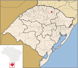
Getúlio Vargas è un comune del Brasile nello Stato del Rio Grande do Sul, parte della mesoregione del Noroeste Rio-Grandense e della microregione di Erechim.
| Getúlio Vargas comune | ||
|---|---|---|
| ||
 | ||
| Localizzazione | ||
| Stato | ||
| Stato federato | ||
| Mesoregione | Noroeste Rio-Grandense | |
| Microregione | Erechim | |
| Amministrazione | ||
| Sindaco | Pedro Paulo Prezzotto | |
| Territorio | ||
| Coordinate | 27°53′16″S 52°13′34″W | |
| Altitudine | 637 e 636 m s.l.m. | |
| Superficie | 286,566 km² | |
| Abitanti | 16 154[1] (2010) | |
| Densità | 56,37 ab./km² | |
| Altre informazioni | ||
| Cod. postale | 99900-000 | |
| Prefisso | 54 | |
| Fuso orario | UTC-3 | |
| Codice IBGE | 4308904 | |
| Nome abitanti | getuliense | |
| Cartografia | ||
 Getúlio Vargas | ||
 | ||
| Sito istituzionale | ||

Storia
Questo comune fu creato il 18 dicembre 1934 con Decreto 5788, assorbendo i due Comuni di Erechim e Passo Fundo, anche se già nel 1908 si trovavano in quella zona degli insediamenti umani.
Il nome di Getúlio Vargas fu suggerito dal presidente della Commissione d'emancipazione della Città, Mathias Lorenzon, in onore del Presidente Getúlio Vargas.
Fu poi approvato dal Generale Flores da Cunha, Interventor Federale (Presidente dello Stato nominato dal Presidente della Repubblica).
Note
- (PT) Scheda del comune dall'IBGE - Censimento 2010, su cod.ibge.gov.br. URL consultato il 26 giugno 2015.
Altri progetti
 Wikimedia Commons contiene immagini o altri file su Getúlio Vargas
Collegamenti esterni
- Sito ufficiale, su pmgv.rs.gov.br.
На других языках
[de] Getúlio Vargas (Rio Grande do Sul)
Getúlio Vargas, amtlich portugiesisch Município de Getúlio Vargas, ist eine Kleinstadt des brasilianischen Bundesstaates Rio Grande do Sul. Sie wurde nach dem zweimaligen Präsidenten und Diktator Getúlio Vargas benannt. Die Entfernung zur Hauptstadt Porto Alegre beträgt 333 km. Die Bevölkerungszahl wurde zum 1. Juli 2019 auf 16.212 Einwohner geschätzt, die auf einer Gemeindefläche von rund 287,1 km² leben und Getulienser (getulienses) genannt werden.[3] Sie steht an 118. Stelle der 497 Munizips des Bundesstaates.[fr] Getúlio Vargas (Rio Grande do Sul)
Floriano Peixoto est une municipalité du Nord-Ouest de l'État du Rio Grande do Sul faisant partie de la microrégion d'Erechim et située à 333 km au nord-ouest de Porto Alegre, capitale de l'État. Elle se situe à une latitude de 27° 53′ 25″ sud et à une longitude de 52° 13′ 39″ ouest, à une altitude de 637 mètres. Sa population était estimée à 15 961, pour une superficie de 287 km2. On y accède par les RS-135 et RS-475. Elle a été nommée en l'honneur de Getúlio Vargas.- [it] Getúlio Vargas (Rio Grande do Sul)
[ru] Жетулиу Варгас (муниципалитет)
Жетулиу Варгас (порт. Getúlio Vargas) — муниципалитет в Бразилии, входит в штат Риу-Гранди-ду-Сул. Составная часть мезорегиона Северо-запад штата Риу-Гранди-ду-Сул. Входит в экономико-статистический микрорегион Эрешин. Население составляет 16 095 человек на 2006 год. Занимает площадь 286,564 км². Плотность населения — 56,2 чел./км².Текст в блоке "Читать" взят с сайта "Википедия" и доступен по лицензии Creative Commons Attribution-ShareAlike; в отдельных случаях могут действовать дополнительные условия.
Другой контент может иметь иную лицензию. Перед использованием материалов сайта WikiSort.org внимательно изучите правила лицензирования конкретных элементов наполнения сайта.
Другой контент может иметь иную лицензию. Перед использованием материалов сайта WikiSort.org внимательно изучите правила лицензирования конкретных элементов наполнения сайта.
2019-2025
WikiSort.org - проект по пересортировке и дополнению контента Википедии
WikiSort.org - проект по пересортировке и дополнению контента Википедии