world.wikisort.org - Brasile
Curralinho è un comune del Brasile nello Stato del Pará, parte della mesoregione di Marajó e della microregione di Furos de Breves.
| Curralinho comune | |||
|---|---|---|---|
| |||
| Localizzazione | |||
| Stato | |||
| Stato federato | |||
| Mesoregione | Marajó | ||
| Microregione | Furos de Breves | ||
| Amministrazione | |||
| Sindaco | José Leonaldo dos Santos Arruda | ||
| Territorio | |||
| Coordinate | 1°48′39″S 49°47′53″W | ||
| Altitudine | 15 e 14 m s.l.m. | ||
| Superficie | 3 617,252 km² | ||
| Abitanti | 28 549[1] (2010) | ||
| Densità | 7,89 ab./km² | ||
| Altre informazioni | |||
| Prefisso | 91 | ||
| Fuso orario | UTC-3 | ||
| Codice IBGE | 1502806 | ||
| Nome abitanti | curralinense | ||
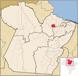
| Cartografia | |||
 Curralinho | |||
 | |||


Note
- (PT) Scheda del comune dall'IBGE - Censimento 2010, su cod.ibge.gov.br. URL consultato il 9 novembre 2014.
Voci correlate
Altri progetti
 Wikimedia Commons contiene immagini o altri file su Curralinho
На других языках
[en] Curralinho
Curralinho is a Brazilian municipality located in the state of Pará. Its population as of 2020 is estimated to be 34,994 people. The area of the municipality is 3.617,240 km². The city belongs to the mesoregion Marajó and to the microregion of Furos de Breves.[fr] Curralinho
Curralinho est une municipalité brésilienne située dans l'État du Pará.- [it] Curralinho
[ru] Курралинью
Курралинью (порт. Curralinho) — муниципалитет в Бразилии, входит в штат Пара. Составная часть мезорегиона Маражо. Входит в экономико-статистический микрорегион Фурус-ди-Бревис. Население составляет 28 549 человек на 2010 год. Занимает площадь 3 617,252 км². Плотность населения — 7,89 чел./км².Текст в блоке "Читать" взят с сайта "Википедия" и доступен по лицензии Creative Commons Attribution-ShareAlike; в отдельных случаях могут действовать дополнительные условия.
Другой контент может иметь иную лицензию. Перед использованием материалов сайта WikiSort.org внимательно изучите правила лицензирования конкретных элементов наполнения сайта.
Другой контент может иметь иную лицензию. Перед использованием материалов сайта WikiSort.org внимательно изучите правила лицензирования конкретных элементов наполнения сайта.
2019-2026
WikiSort.org - проект по пересортировке и дополнению контента Википедии
WikiSort.org - проект по пересортировке и дополнению контента Википедии