world.wikisort.org - Brasile
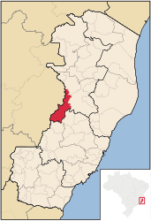
Baixo Guandu è un comune del Brasile nello Stato dell'Espírito Santo, parte della mesoregione del Noroeste Espírito-Santense e della microregione di Colatina.
| Baixo Guandu comune | |||
|---|---|---|---|
| |||
 | |||
| Localizzazione | |||
| Stato | |||
| Stato federato | |||
| Mesoregione | Noroeste Espírito-Santense | ||
| Microregione | Colatina | ||
| Amministrazione | |||
| Sindaco | José de Barros Neto | ||
| Territorio | |||
| Coordinate | 19°30′42″S 41°01′12″W | ||
| Altitudine | 78 m s.l.m. | ||
| Superficie | 917,070 km² | ||
| Abitanti | 29 081[1] (2010) | ||
| Densità | 31,71 ab./km² | ||
| Altre informazioni | |||
| Cod. postale | 29730-000 – 29744-999 | ||
| Prefisso | 27 | ||
| Fuso orario | UTC-3 | ||
| Codice IBGE | 3200805 | ||
| Nome abitanti | guanduense | ||
| Cartografia | |||
 Baixo Guandu | |||
 | |||
| Sito istituzionale | |||


Note
- (PT) Scheda del comune dall'IBGE - Censimento 2010, su cidades.ibge.gov.br. URL consultato il 13 dicembre 2013.
Altri progetti
 Wikimedia Commons contiene immagini o altri file su Baixo Guandu
Collegamenti esterni
- Sito ufficiale, su pmbg.es.gov.br.
| Controllo di autorità | VIAF (EN) 123237755 · LCCN (EN) n86070486 |
|---|
На других языках
[de] Baixo Guandu
Baixo Guandu, amtlich Município de Baixo Guandu, ist eine an der Westgrenze des brasilianischen Bundesstaates Espírito Santo gelegene Stadt. Sie wurde 1935 gegründet und hatte im Jahr 2010 knapp 30.000 Einwohner, die vom brasilianischen Statistikinstitut zum 1. Juli 2021 auf 104.942 Einwohner, die Guanduenser genannt werden, geschätzt wurden.[1][en] Baixo Guandu
Baixo Guandu is a municipality located in the Brazilian state of Espírito Santo that was founded on April 10, 1935 and established as a city on June 8, same year. The city's celebration day is April 10. Its population was 31,132 (2020) and its area is 918 km². The area is most well known for its exports of coffee, especially from the high mountains of the district of Alto Mutum Preto. The main watercourse through the municipality is the Rio Doce river ("Doce" means sweet in Portuguese) whose basin (of 83,500 square kilometers) is composed of 222 municipalities.[fr] Baixo Guandu
Baixo Guandu est une ville située dans l'État brésilien du Espirito Santo, fondée le 10 avril 1935 et établie comme une municipalité le 8 juin de la même année. La Fête de la ville est le 10 avril. En 2009, sa population était de 29 891 habitants et sa superficie est de 918 km2[2]. La région est plus connue pour ses exportations de café, surtout dans les hautes montagnes de la région d'Alto Mutum Preto. Le cours d'eau principal qui traverse la municipalité est le fleuve Rio Doce ( "doce" signifie sucrée en portugais) dont le bassin (de 83 500 km2) est composé de 222 municipalités.- [it] Baixo Guandu
[ru] Байшу-Гуанду
Байшу-Гуанду (порт. Baixo Guandu) — муниципалитет в Бразилии, входит в штат Эспириту-Санту. Составная часть мезорегиона Северо-запад штата Эспириту-Санту. Входит в экономико-статистический микрорегион Колатина. Население составляет 29 610 человек на 2005 год. Занимает площадь 917,888 км². Плотность населения — 32,25 чел./км².Текст в блоке "Читать" взят с сайта "Википедия" и доступен по лицензии Creative Commons Attribution-ShareAlike; в отдельных случаях могут действовать дополнительные условия.
Другой контент может иметь иную лицензию. Перед использованием материалов сайта WikiSort.org внимательно изучите правила лицензирования конкретных элементов наполнения сайта.
Другой контент может иметь иную лицензию. Перед использованием материалов сайта WikiSort.org внимательно изучите правила лицензирования конкретных элементов наполнения сайта.
2019-2026
WikiSort.org - проект по пересортировке и дополнению контента Википедии
WikiSort.org - проект по пересортировке и дополнению контента Википедии