world.wikisort.org - Brésil
Santos Dumont est une municipalité du Brésil dans l'État du Minas Gerais.
Pour les articles homonymes, voir Santos Dumont (homonymie).
| Santos Dumont Surnom : "Princesinha da Mantiqueira" "Terra do Pai da Aviação" | |
 Héraldique |
 Drapeau |
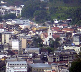
 Centre ville | |
| Administration | |
|---|---|
| Pays | |
| Région | Sud-Est |
| État | |
| Maire | Carlos Alberto Ramos de Faria (PP) |
| Démographie | |
| Gentilé | sandumonense |
| Population | 46 289 hab.[1] (2010) |
| Densité | 73 hab./km2 |
| Géographie | |
| Coordonnées | 21° 27′ 24″ sud, 43° 33′ 09″ ouest |
| Altitude | 839 m |
| Superficie | 63 737,7 ha = 637,377 km2 |
| Divers | |
| Date de fondation | 27 juillet 1889 |
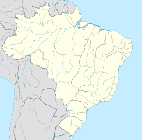
| Localisation | |
| Liens | |
| Site web | http://www.santosdumont.mg.gov.br |
| modifier |
|
Elle s’appelait Palmira au XIXe siècle, avant d’être rebaptisée en hommage au pionnier de l’aviation Alberto Santos Dumont.
Annexes
Articles connexes
- Alberto Santos-Dumont
Notes et références
- IBGE
- Portail du Minas Gerais
На других языках
[en] Santos Dumont, Minas Gerais
Santos Dumont (formerly known as Palmira) is a municipality in southern Minas Gerais state, Brazil. The population (2020) is estimated to be 46,421 and the total area of the municipality is 639.1 km2 (246.8 sq mi). It lies at an elevation of 839 m (2,753 ft) just off the main interstate highway, BR040, between the urban centers of Barbacena (north) and Juiz de Fora (south). It is 240 km (150 mi) from the state capital, Belo Horizonte, and 220 km (140 mi) from Rio de Janeiro. It became a city in 1889.- [fr] Santos Dumont
[ru] Сантус-Думонт (Минас-Жерайс)
Сантус-Думонт (порт. Santos Dumont) — муниципалитет в Бразилии, входит в штат Минас-Жерайс. Составная часть мезорегиона Зона-да-Мата. Входит в экономико-статистический микрорегион Жуис-ди-Фора. Население составляет 49 137 человек на 2006 год. Занимает площадь 637,377 км². Плотность населения — 75,5 чел./км².Текст в блоке "Читать" взят с сайта "Википедия" и доступен по лицензии Creative Commons Attribution-ShareAlike; в отдельных случаях могут действовать дополнительные условия.
Другой контент может иметь иную лицензию. Перед использованием материалов сайта WikiSort.org внимательно изучите правила лицензирования конкретных элементов наполнения сайта.
Другой контент может иметь иную лицензию. Перед использованием материалов сайта WikiSort.org внимательно изучите правила лицензирования конкретных элементов наполнения сайта.
2019-2025
WikiSort.org - проект по пересортировке и дополнению контента Википедии
WikiSort.org - проект по пересортировке и дополнению контента Википедии


