world.wikisort.org - Brésil
Pedras Altas est une ville brésilienne du Sud-Est de l'État du Rio Grande do Sul, faisant partie de la microrégion de Jaguarão et située à 386 km au sud-ouest de Porto Alegre, capitale de l'État. Elle se situe à une latitude de 31° 44′ 01″ sud et à une longitude de 53° 35′ 04″ ouest. Sa population était estimée à 2 546 en 2007, pour une superficie de 1 377 km2.
| Pedras Altas Devise : Paz em trablaho (paix au travail) | ||||
 Héraldique |
 Drapeau |
|||
| Administration | ||||
|---|---|---|---|---|
| Pays | ||||
| Région | Sud | |||
| État | ||||
| Langue(s) | portugais | |||
| Maire | Gabriel de Lellis Junior | |||
| Code postal | 96 870-000 | |||
| Fuseau horaireHeure d'été | UTC-3UTC-2 | |||
| Indicatif | 53 | |||
| Démographie | ||||
| Gentilé | Pedras-altense | |||
| Population | 2 546 hab.[1] (01-04-2007) | |||
| Densité | 1,8 hab./km2 | |||
| Géographie | ||||
| Coordonnées | 31° 44′ 01″ sud, 53° 35′ 04″ ouest | |||
| Superficie | 137 700 ha = 1 377 km2 | |||
| Divers | ||||
| Site(s) touristique(s) | Tourisme rural | |||
| Localisation | ||||
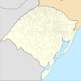
| Géolocalisation sur la carte : Rio Grande do Sul
Géolocalisation sur la carte : Brésil
Géolocalisation sur la carte : Brésil
| ||||
| Liens | ||||
| Site web | http://www.pedrasaltas.rs.gov.br/ | |||
| modifier |
||||


Pedras Altas doit son nom à sa géologie, qui présente d'énormes pierres à 3 km du Centre de la cité.
La commune fait frontière avec l'Uruguay par son département de Cerro Largo.
Villes voisines
Notes et références
- IBGE
 Portail du Rio Grande do Sul
На других языках
[en] Pedras Altas
Pedras Altas (Portuguese meaning "High Rocks") is a Brazilian municipality in the southern part of the state of Rio Grande do Sul. The population is 1,954 (2020 est.) in an area of 1377.37 km2.[2] The Jaguarão River, which forms the border with Uruguay here, flows along the southwestern part of the municipality.- [fr] Pedras Altas
[ru] Педрас-Алтас
Педрас-Алтас (порт. Pedras Altas) — муниципалитет в Бразилии, входит в штат Риу-Гранди-ду-Сул. Составная часть мезорегиона Юго-восток штата Риу-Гранди-ду-Сул. Входит в экономико-статистический микрорегион Серрас-ди-Судести. Население составляет 2784 человека на 2006 год. Занимает площадь 1 376,694 км². Плотность населения — 2,0 чел./км².Текст в блоке "Читать" взят с сайта "Википедия" и доступен по лицензии Creative Commons Attribution-ShareAlike; в отдельных случаях могут действовать дополнительные условия.
Другой контент может иметь иную лицензию. Перед использованием материалов сайта WikiSort.org внимательно изучите правила лицензирования конкретных элементов наполнения сайта.
Другой контент может иметь иную лицензию. Перед использованием материалов сайта WikiSort.org внимательно изучите правила лицензирования конкретных элементов наполнения сайта.
2019-2026
WikiSort.org - проект по пересортировке и дополнению контента Википедии
WikiSort.org - проект по пересортировке и дополнению контента Википедии