world.wikisort.org - Brésil
Itu est une ville brésilienne de l'État de São Paulo (interior de São Paulo). Sa population était estimée à 155 589 habitants. La municipalité s'étend sur 640 km2.
Pour les articles homonymes, voir Itu.
| Itu Surnom : Berço da República | ||||
 Héraldique |
 Drapeau |
|||
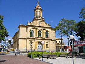
 Vue de Itu | ||||
| Administration | ||||
|---|---|---|---|---|
| Pays | ||||
| Région | Sud-Est | |||
| État | ||||
| Langue(s) | portugais | |||
| Maire | Herculano Castilho Passos Júnior (PV) | |||
| Fuseau horaireHeure d'été | UTC-3UTC-4 | |||
| Démographie | ||||
| Gentilé | ituano | |||
| Population | 155 589 hab.[1] (2010) | |||
| Densité | 243 hab./km2 | |||
| Géographie | ||||
| Coordonnées | 23° 09′ 22″ sud, 47° 10′ 32″ ouest | |||
| Altitude | 583 m |
|||
| Superficie | 63 998,1 ha = 639,981 km2 | |||
| Divers | ||||
| Date de fondation | ||||
| Localisation | ||||
| Géolocalisation sur la carte : État de São Paulo
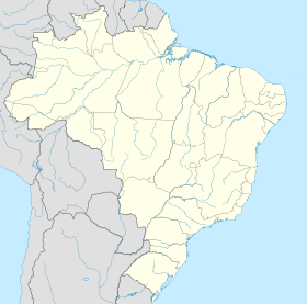
Géolocalisation sur la carte : Brésil
Géolocalisation sur la carte : Brésil
| ||||
| Liens | ||||
| Site web | http://www.itu.sp.gov.br/ | |||
| modifier |
||||
Elle accueille durant le mois de la version sud-américaine du festival electro Tomorrowland[2].
Maires
Notes et références
- IBGE
- « Tomorrowland Brasil: 180 000 tickets vendus en à peine trois heures », sur rtbf.be, (consulté le )
Lien externe
- Portail de l'État de São Paulo
На других языках
[en] Itu, São Paulo
Itu is an historic municipality in the state of São Paulo in Brazil. It is part of the Metropolitan Region of Sorocaba.[3] The population was 175,568 as of 2020, in an area of 640.72 km2.[4] The elevation is 583 m. This place name comes from the Tupi language, meaning big waterfall. Two rivers flow through Itu: Tietê and Jundiaí. Itu has five hospitals, eleven bank agencies and one shopping center, the Plaza Shopping Itu.- [fr] Itu (Brésil)
[ru] Иту
Иту (порт. Itu) — муниципалитет в Бразилии, входит в штат Сан-Паулу. Составная часть мезорегиона Макрорегион агломерации Сан-Паулу. Входит в экономико-статистический микрорегион Сорокаба. Население составляет 170 157 человек на 2017 год. Занимает площадь 639,981 км². Плотность населения — 265,9 чел./км².Текст в блоке "Читать" взят с сайта "Википедия" и доступен по лицензии Creative Commons Attribution-ShareAlike; в отдельных случаях могут действовать дополнительные условия.
Другой контент может иметь иную лицензию. Перед использованием материалов сайта WikiSort.org внимательно изучите правила лицензирования конкретных элементов наполнения сайта.
Другой контент может иметь иную лицензию. Перед использованием материалов сайта WikiSort.org внимательно изучите правила лицензирования конкретных элементов наполнения сайта.
2019-2025
WikiSort.org - проект по пересортировке и дополнению контента Википедии
WikiSort.org - проект по пересортировке и дополнению контента Википедии


