world.wikisort.org - Brésil
Itaporanga d'Ajuda est une ville brésilienne du sud de l'État du Sergipe.
Pour les articles homonymes, voir Itaporanga.
| Itaporanga d'Ajuda | |
 Héraldique |
|
 Plage de Caueira, Itaporanga d'Ajuda | |
| Administration | |
|---|---|
| Pays | |
| Région | Nord-Est |
| État | |
| Langue(s) | portugais |
| Maire | César Fonseca Mandarino (PSC) |
| Fuseau horaire | UTC-3 |
| Démographie | |
| Gentilé | itaporanguense |
| Population | 28 122 hab.[1] (04/2007) |
| Densité | 37 hab./km2 |
| Géographie | |
| Coordonnées | 10° 59′ 52″ sud, 37° 18′ 39″ ouest |
| Altitude | 9 m |
| Superficie | 75 700 ha = 757 km2 |
| Divers | |
| Date de fondation | 28 mars 1854 |
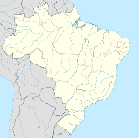
| Localisation | |
| Liens | |
| Site web | http://www.itaporanga.se.gov.br/ |
| modifier |
|
Géographie
Itaporanga d'Ajuda se situe à une latitude de 10° 59' 52" sud et par une longitude de 37° 18' 39" ouest, à une altitude de 9 mètres.
Sa population était de 28 122 habitants au recensement de 2007[2]. La municipalité s'étend sur 757 km2[3].
Elle fait partie de la microrégion d'Estância, dans la mésorégion Est du Sergipe.
Maires
Liens externes
Références
- Portail du Sergipe
На других языках
[en] Itaporanga d'Ajuda
Itaporanga d'Ajuda is a Brazilian municipality in the Northeastern state of Sergipe. It covers 757 square kilometres (292 sq mi), has a population of 34,709 (2020) and a population density of 46 residents per km2 (120/sq mi).[1] It is home to the Tejupeba House and the Chapel of the Colégio Sugar Plantation, a plantation house and chapel cited as the first Jesuits settlement in Portuguese Brazil.- [fr] Itaporanga d'Ajuda
[ru] Итапоранга-д’Ажуда
Итапоранга-д’Ажуда (порт. Itaporanga d'Ajuda) — муниципалитет в Бразилии, входит в штат Сержипи. Составная часть мезорегиона Восток штата Сержипи. Входит в экономико-статистический микрорегион Эстансия. Население составляет 28 714 человека на 2005 год. Занимает площадь 757,28 км². Плотность населения — 26,4 чел./км².Текст в блоке "Читать" взят с сайта "Википедия" и доступен по лицензии Creative Commons Attribution-ShareAlike; в отдельных случаях могут действовать дополнительные условия.
Другой контент может иметь иную лицензию. Перед использованием материалов сайта WikiSort.org внимательно изучите правила лицензирования конкретных элементов наполнения сайта.
Другой контент может иметь иную лицензию. Перед использованием материалов сайта WikiSort.org внимательно изучите правила лицензирования конкретных элементов наполнения сайта.
2019-2025
WikiSort.org - проект по пересортировке и дополнению контента Википедии
WikiSort.org - проект по пересортировке и дополнению контента Википедии


