world.wikisort.org - Brésil
Itapetininga est une ville brésilienne appartenant à l'État de São Paulo. Sa population était estimée à 160 070 habitants en 2017. Elle devient politiquement autonome en 1770.
| Itapetininga Surnom : Atenas do SulDevise : Construire le futur ! | |
 Héraldique |
 Drapeau |
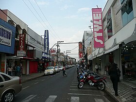
 Vue de Itapetininga | |
| Administration | |
|---|---|
| Pays | |
| Région | Sud-Est |
| État | |
| Langue(s) | portugais |
| Maire | Roberto Ramalho Tavares (PMDB) |
| Fuseau horaireHeure d'été | UTC-3UTC-4 |
| Démographie | |
| Gentilé | itapetiningano |
| Population | 144 416 hab.[1] (2010) |
| Densité | 81 hab./km2 |
| Géographie | |
| Coordonnées | 23° 21′ 11″ sud, 48° 01′ 52″ ouest |
| Altitude | 656 m |
| Superficie | 179 207,9 ha = 1 792,079 km2 |
| Divers | |
| Date de fondation | |
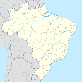
| Localisation | |
| Liens | |
| Site web | http://www.itapetininga.sp.gov.br/ |
| modifier |
|
Maires
Notes et références
- IBGE
Lien externe
- Itapetininga sur citybrazil.com
- Portail de l'État de São Paulo
На других языках
[de] Itapetininga
Itapetininga ist eine Stadt im Bundesstaat São Paulo, Brasilien. Der Name stammt aus einer Tupí-Sprache. Im Jahr 2018 lebten schätzungsweise 162.231 Menschen in Itapetininga.[1][en] Itapetininga
Itapetininga is a municipality in the state of São Paulo, Brazil. The population is 165,526 (2020 est.) in an area of 1790 km2.[2] The name comes from a Tupi-Guarani language, meaning "dry stone".[3][es] Itapetininga
Itapetininga es un municipio brasileño del estado de São Paulo, situado en latitud 23º35'30" sur y longitud 48º03'11" oeste, estando a una altitud de 656 metros sobre el nivel del mar, y a unos 170 kilómetros de la ciudad de São Paulo. Su población estimada en 2008, era de 156.075 habitantes. Además, es la tercera ciudade más grande- [fr] Itapetininga
[ru] Итапетининга
Итапетининга (порт. Itapetininga) — муниципалитет в Бразилии, входит в штат Сан-Паулу. Составная часть мезорегиона Итапетининга. Входит в экономико-статистический микрорегион Итапетининга. Население составляет 143 097 человек на 2006 год. Занимает площадь 1 792,079 км². Плотность населения — 79,8 чел./км².Текст в блоке "Читать" взят с сайта "Википедия" и доступен по лицензии Creative Commons Attribution-ShareAlike; в отдельных случаях могут действовать дополнительные условия.
Другой контент может иметь иную лицензию. Перед использованием материалов сайта WikiSort.org внимательно изучите правила лицензирования конкретных элементов наполнения сайта.
Другой контент может иметь иную лицензию. Перед использованием материалов сайта WikiSort.org внимательно изучите правила лицензирования конкретных элементов наполнения сайта.
2019-2025
WikiSort.org - проект по пересортировке и дополнению контента Википедии
WikiSort.org - проект по пересортировке и дополнению контента Википедии


