world.wikisort.org - Brésil
Itapetinga est une municipalité brésilienne de l'État de Bahia et la Microrégion d'Itapetinga.
| Itapetinga Surnom : "Cidade do Boi Gordo"Devise : Terra firmus, pecus fortis | |

| |
| Administration | |
|---|---|
| Pays | |
| Région | Microrégion d'Itapetinga |
| État | |
| Maire | José Carlos Moura |
| Fuseau horaire | UTC-3 |
| Démographie | |
| Gentilé | itapetinguense |
| Population | 74 652 hab.[1] (2013) |
| Densité | 46 hab./km2 |
| Géographie | |
| Coordonnées | 15° 15′ 12,48″ sud, 40° 15′ 19,78″ ouest |
| Altitude | 280 m |
| Superficie | 162 751,8 ha = 1 627,518 km2 |
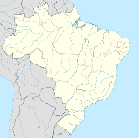
| Localisation | |
| Liens | |
| Site web | http://www.itapetinga.ba.gov.br/ |
| modifier |
|
Notes et références
- IBGE
- Portail de Bahia
На других языках
[en] Itapetinga
Itapetinga, Bahia, Brazil is a municipality in the state of Bahia in the North-East region of Brazil.[2] Its population in 2020, according to estimates by the IBGE, was 76,795, so it is the 24th most populous municipality of Bahia.[3][4]- [fr] Itapetinga
[ru] Итапетинга
Итапетинга (порт. Itapetinga) — муниципалитет в Бразилии, входит в штат Баия. Составная часть мезорегиона Юго-центральная часть штата Баия. Входит в экономико-статистический микрорегион Итапетинга. Население составляет 63 243 человека на 2007 год. Занимает площадь 1 609,515 км². Плотность населения — 39,29 чел./км².Текст в блоке "Читать" взят с сайта "Википедия" и доступен по лицензии Creative Commons Attribution-ShareAlike; в отдельных случаях могут действовать дополнительные условия.
Другой контент может иметь иную лицензию. Перед использованием материалов сайта WikiSort.org внимательно изучите правила лицензирования конкретных элементов наполнения сайта.
Другой контент может иметь иную лицензию. Перед использованием материалов сайта WikiSort.org внимательно изучите правила лицензирования конкретных элементов наполнения сайта.
2019-2025
WikiSort.org - проект по пересортировке и дополнению контента Википедии
WikiSort.org - проект по пересортировке и дополнению контента Википедии


