world.wikisort.org - Brésil
Ipojuca est une ville brésilienne du littoral de l'État du Pernambouc.
| Ipojuca | |
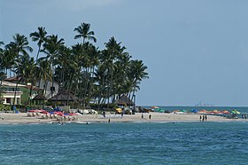
 Plage de Porto de Galinhas - Pernambuco - Brésil | |
| Administration | |
|---|---|
| Pays | |
| Région | Nord-Est |
| État | |
| Langue(s) | portugais |
| Maire | Pedro Serafim (PDT) |
| Fuseau horaire | UTC-3 |
| Indicatif | 81 |
| Démographie | |
| Gentilé | ipojucano |
| Population | 69 781 hab.[1] (04/2007) |
| Densité | 132 hab./km2 |
| Géographie | |
| Coordonnées | 8° 24′ 00″ sud, 35° 03′ 45″ ouest |
| Altitude | 10 m |
| Superficie | 52 700 ha = 527 km2 |
| Divers | |
| Date de fondation | 1861 |
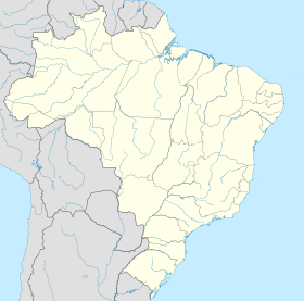
| Localisation | |
| modifier |
|
Géographie
Ipojuca se situe par une latitude de 08° 24′ 00″ sud et par une longitude de 35° 03′ 45″ ouest, à une altitude de 10 mètres.
Sa population était de 69 781 habitants au recensement de 2007[2]. La municipalité s'étend sur 527 km2[3].
Elle fait partie de la microrégion de Suape, dans la mésorégion métropolitaine de Recife.
Elle fait également partie de la région métropolitaine de Recife.
Références
- Portail du Pernambouc
На других языках
[en] Ipojuca
Ipojuca is a municipality in Pernambuco in eastern Brazil. As of 2020 the population according to IBGE was 97,669 and the per capita income (2007) was R$76.418 (more than $23,000 US dollars) making it one of the country's highest. The settlement dates to 1560, but the official founding date is 1861 and the community was incorporated as a town in 1864. It is famous for its beaches such as Porto de Galinhas (considered one of the best beaches in Brazil), Muro Alto, Maracaipe.- [fr] Ipojuca
[ru] Ипожука
Ипожука (порт. Ipojuca) — муниципалитет в Бразилии, входит в штат Пернамбуку. Составная часть мезорегиона Агломерация Ресифи. Входит в экономико-статистический микрорегион Суапи. Население составляет 70 070 человек на 2007 год. Занимает площадь 527,32 км². Плотность населения — 132,9 чел./км².Текст в блоке "Читать" взят с сайта "Википедия" и доступен по лицензии Creative Commons Attribution-ShareAlike; в отдельных случаях могут действовать дополнительные условия.
Другой контент может иметь иную лицензию. Перед использованием материалов сайта WikiSort.org внимательно изучите правила лицензирования конкретных элементов наполнения сайта.
Другой контент может иметь иную лицензию. Перед использованием материалов сайта WikiSort.org внимательно изучите правила лицензирования конкретных элементов наполнения сайта.
2019-2025
WikiSort.org - проект по пересортировке и дополнению контента Википедии
WikiSort.org - проект по пересортировке и дополнению контента Википедии


