world.wikisort.org - Brésil
Botucatu est une ville brésilienne de l'État de São Paulo. Sa population est estimée à 141 032 habitants en . La municipalité s'étend sur 1 483 km2.
| Botucatu Surnom : Cidade dos bons ares | ||||
 Héraldique |
 Drapeau |
|||
 Vue de Botucatu | ||||
| Administration | ||||
|---|---|---|---|---|
| Pays | ||||
| Région | Sud-Est | |||
| État | ||||
| Langue(s) | portugais | |||
| Maire | João Cury Neto (PSDB) | |||
| Fuseau horaireHeure d'été | UTC-3UTC-4 | |||
| Démographie | ||||
| Gentilé | botucatuense | |||
| Population | 130 348 hab.[1] (04/2009) | |||
| Densité | 88 hab./km2 | |||
| Géographie | ||||
| Coordonnées | 22° 31′ 51″ sud, 48° 15′ 51″ ouest | |||
| Altitude | 804 m |
|||
| Superficie | 148 287,4 ha = 1 482,874 km2 | |||
| Divers | ||||
| Date de fondation | ||||
| Localisation | ||||
| Géolocalisation sur la carte : État de São Paulo
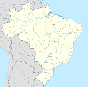
Géolocalisation sur la carte : Brésil
Géolocalisation sur la carte : Brésil
| ||||
| Liens | ||||
| Site web | http://www.botucatu.sp.gov.br/ | |||
| modifier |
||||
Cette ville possède un climat doux (température moyenne 22 °C) et son altitude est relativement élevée, elle varie de 756 mètres en plaine à 920 mètres à son point le plus haut.
Il existe au moins deux interprétations étymologiques du nom de cette ville:
- il proviendrait du terme tupi ybytukatu, qui signifie "bons airs, bons vents", à travers la jonction des termes ybytu ("air, vent") et katu ("bon");
- il signifierait "bonne montagne", de la jonction des mots tupi ybytyra ("montagne" dans la variante de la langue parlée dans l'État de São Paulo) et katu ("bon").
Personnalités liées à la ville
- Mário Eduardo Viaro (1968-),linguiste et traducteur brésilien, y est né.
Notes et références
- IBGE
2. Botucatu
- Portail de l'État de São Paulo
На других языках
[de] Botucatu
Botucatu ist eine Stadt im brasilianischen Bundesstaat São Paulo. Sie hatte im Jahr 2010 etwa 127.000 Einwohner.[en] Botucatu
Botucatu is a city in the southeastern region of Brazil and is located 224.8 km (139.7 mi) from São Paulo, the capital of the state of São Paulo. It has an estimated population of 148,130 (as of 2020) in an area of 1,482.64 km2 (572 sq mi).[1] It lies on the top of a plateau (804 metres (2,638 feet) high).[citation needed] Botucatu became a village in 1855, and a city in 1876.[2][es] Botucatu
Botucatu es un municipio brasileño en el interior del estado de São Paulo. Se localiza a 22º53'09" de latitud sur, 48º26'42" de longitud oeste, a 920 metros de altitud. Distancia 235 km de la capital São Paulo. La población estimada en 2018 fue de 144.820 habitantes.[6] El nombre del municipio proviene de Ybytu katu, que en tupí significa "buenos aires".'- [fr] Botucatu
[ru] Ботукату
Ботукату (порт. Botucatu) — муниципалитет в Бразилии, входит в штат Сан-Паулу. Составная часть мезорегиона Бауру. Входит в экономико-статистический микрорегион Ботукату. Население составляет 120 800 человек на 2007 год. Занимает площадь 1 482,874 км². Плотность населения — 81,5 чел./км².Текст в блоке "Читать" взят с сайта "Википедия" и доступен по лицензии Creative Commons Attribution-ShareAlike; в отдельных случаях могут действовать дополнительные условия.
Другой контент может иметь иную лицензию. Перед использованием материалов сайта WikiSort.org внимательно изучите правила лицензирования конкретных элементов наполнения сайта.
Другой контент может иметь иную лицензию. Перед использованием материалов сайта WikiSort.org внимательно изучите правила лицензирования конкретных элементов наполнения сайта.
2019-2025
WikiSort.org - проект по пересортировке и дополнению контента Википедии
WikiSort.org - проект по пересортировке и дополнению контента Википедии


