world.wikisort.org - Brésil
Tomar do Geru est une municipalité brésilienne située dans l'État du Sergipe.
| Tomar do Geru | ||||
| Administration | ||||
|---|---|---|---|---|
| Pays | ||||
| État | ||||
| Langue(s) | portugais | |||
| Fuseau horaire | UTC-3 | |||
| Démographie | ||||
| Population | 13 192 hab.[1] (2013) | |||
| Densité | 46 hab./km2 | |||
| Géographie | ||||
| Coordonnées | 11° 22′ 22″ sud, 37° 50′ 27″ ouest | |||
| Superficie | 28 765,8 ha = 287,658 km2 | |||
| Localisation | ||||
| Géolocalisation sur la carte : Sergipe
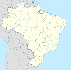
Géolocalisation sur la carte : Brésil
Géolocalisation sur la carte : Brésil
| ||||
| modifier |
||||
Notes et références
- IBGE
- Portail du Brésil
На других языках
[en] Tomar do Geru
Tomar do Geru is a municipality located in the Brazilian state of Sergipe. Its population was 13,535 (2020) and it covers 305 km2 (118 sq mi). Tomar do Geru has a population density of 43 inhabitants per square kilometer. It is located 131 km (81 mi) from the state capital of Sergipe, Aracaju.[2] The Church of Nossa Senhora do Socorro was built by the Society of Jesus in 1688. It was listed as a historic structure by the Brazilian National Institute of Historic and Artistic Heritage (IPHAN) in 1943.[3]- [fr] Tomar do Geru
[ru] Томар-ду-Жеру
Томар-ду-Жеру (порт. Tomar do Geru) — муниципалитет в Бразилии, входит в штат Сержипи. Составная часть мезорегиона Восток штата Сержипи. Входит в экономико-статистический микрорегион Бокин.Текст в блоке "Читать" взят с сайта "Википедия" и доступен по лицензии Creative Commons Attribution-ShareAlike; в отдельных случаях могут действовать дополнительные условия.
Другой контент может иметь иную лицензию. Перед использованием материалов сайта WikiSort.org внимательно изучите правила лицензирования конкретных элементов наполнения сайта.
Другой контент может иметь иную лицензию. Перед использованием материалов сайта WikiSort.org внимательно изучите правила лицензирования конкретных элементов наполнения сайта.
2019-2025
WikiSort.org - проект по пересортировке и дополнению контента Википедии
WikiSort.org - проект по пересортировке и дополнению контента Википедии


