world.wikisort.org - Brésil
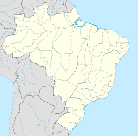
Parintins est une ville brésilienne du Nord-Ouest de l'État de l'Amazonas.
| Parintins Surnom : A Ilha da Alegria | |

| |
| Administration | |
|---|---|
| Pays | |
| Région | Région Nord |
| État | |
| Langue(s) | portugais |
| Maire | Frank Bi Garcia (PSDB) |
| Fuseau horaire | UTC-4 |
| Démographie | |
| Gentilé | parintinense |
| Population | 102 044 hab.[1] (04/2007) |
| Densité | 17 hab./km2 |
| Géographie | |
| Coordonnées | 2° 37′ 40″ sud, 56° 44′ 09″ ouest |
| Altitude | 27 m |
| Superficie | 595 200 ha = 5 952 km2 |
| Divers | |
| Date de fondation | 15 octobre 1852 |
| Localisation | |
| modifier |
|
Géographie
Parintins se situe sur une presqu'île bordée au sud par l'embouchure du Río Paraná do Ramós (bifurcation de l'Amazone et du río Madeira) et au nord par cours principal de l'Amazone. Sa population était de 102 044 habitants au recensement de 2007[2]. La municipalité s'étend sur 5 952 km2[3].
Références
- IBGE
- Population des municipalités brésiliennes, Institut brésilien de géographie et de statistiques, .
- Institut brésilien de géographie et de statistiques.
- Portail de l’Amazonie
- Portail du Brésil
На других языках
[de] Parintins
Parintins, amtlich Município de Parintins, ist mit 102.033 Einwohnern und einer Fläche von 5.952 km² die zweitgrößte Stadt im brasilianischen Bundesstaat Amazonas. Sie liegt auf der Insel Tupinambarana, 461 km (auf dem Wasserweg, 371 km Luftlinie) entfernt östlich von Manaus, der Hauptstadt des Bundesstaates. Nach einer neueren Schätzung lebten 2019 etwa 114.273 Menschen in Parintins.[3][en] Parintins
Parintins is a municipality in the far east of the Amazonas state of Brazil. It is part of a microregion also named Parintins. The population for the entire municipality was 115,363 (IBGE 2020) and its area is 5,952 km2.[2] The city is located on Tupinambarana island in the Amazon River. Parintins is known for the Parintins Folklore Festival, a popular festival held there each June and depicting Boi-Bumbá. It was also the site of an experimental deployment of WiMAX, sponsored by Intel, in late 2006.[3][es] Parintins
Parintins es un municipio de Brasil situado en el estado de Amazonas. Con una población de 108.250 habitantes es la segunda mayor ciudad del estado. Está situada a 228 km de Manaos y posee un área de 5.952 km².- [fr] Parintins
[ru] Паринтинс
Паринтинс (порт. Parintins) — муниципалитет в Бразилии, входит в штат Амазонас. Составная часть мезорегиона Центр штата Амазонас. Входит в экономико-статистический микрорегион Паринтинс. Население составляет 102 033 человек на 2010 год. Занимает площадь 5 952,04 км². Плотность населения — 17,14 чел./км². Крупнейший населённый пункт амазонского острова Тупинамбарана.Текст в блоке "Читать" взят с сайта "Википедия" и доступен по лицензии Creative Commons Attribution-ShareAlike; в отдельных случаях могут действовать дополнительные условия.
Другой контент может иметь иную лицензию. Перед использованием материалов сайта WikiSort.org внимательно изучите правила лицензирования конкретных элементов наполнения сайта.
Другой контент может иметь иную лицензию. Перед использованием материалов сайта WikiSort.org внимательно изучите правила лицензирования конкретных элементов наполнения сайта.
2019-2025
WikiSort.org - проект по пересортировке и дополнению контента Википедии
WikiSort.org - проект по пересортировке и дополнению контента Википедии


