world.wikisort.org - Brésil
Goianápolis est une municipalité brésilienne de l'État de Goiás et la microrégion de Goiânia.
| Goianápolis Surnom : "Tomatópolis"Devise : Liberdade e Patriotismo | ||||
| Administration | ||||
|---|---|---|---|---|
| Pays | ||||
| Région | Microrégion de Goiânia | |||
| État | ||||
| Maire | Jeová Leite Cardoso | |||
| Fuseau horaire | UTC-3 | |||
| Démographie | ||||
| Gentilé | goianapolino | |||
| Population | 20 681 hab.[1] (2010) | |||
| Densité | 127 hab./km2 | |||
| Géographie | ||||
| Coordonnées | 16° 30′ 39″ sud, 49° 01′ 26″ ouest | |||
| Altitude | 915 m |
|||
| Superficie | 16 238 ha = 162,380 km2 | |||
| Divers | ||||
| Date de fondation | 1958 | |||
| Localisation | ||||
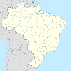
| Géolocalisation sur la carte : Goiás
Géolocalisation sur la carte : Brésil
Géolocalisation sur la carte : Brésil
| ||||
| modifier |
||||
Notes et références
- IBGE
- Portail du Goiás
На других языках
[en] Goianápolis
Goianápolis is a municipality in central Goiás state, Brazil. It had a population of 11,224 (IBGE 2020 estimate) in a total area of 162.38 km2 (2007). The town is famous for its tomato production and as the birthplace of Leandro and Leonardo, one of the most famous country and western duos in recent Brazilian music.- [fr] Goianápolis
[ru] Гоянаполис
Гоянаполис (порт. Goianápolis) — муниципалитет в Бразилии, входит в штат Гояс. Составная часть мезорегиона Центр штата Гойас. Входит в экономико-статистический микрорегион Гояния. Население составляет 13 212 человека на 2006 год. Занимает площадь 162,380 км². Плотность населения — 81,4 чел./км².Текст в блоке "Читать" взят с сайта "Википедия" и доступен по лицензии Creative Commons Attribution-ShareAlike; в отдельных случаях могут действовать дополнительные условия.
Другой контент может иметь иную лицензию. Перед использованием материалов сайта WikiSort.org внимательно изучите правила лицензирования конкретных элементов наполнения сайта.
Другой контент может иметь иную лицензию. Перед использованием материалов сайта WikiSort.org внимательно изучите правила лицензирования конкретных элементов наполнения сайта.
2019-2025
WikiSort.org - проект по пересортировке и дополнению контента Википедии
WikiSort.org - проект по пересортировке и дополнению контента Википедии


