world.wikisort.org - Brésil
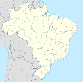
Cotegipe est une municipalité brésilienne de l'État de Bahia et la microrégion de Cotegipe.
| Cotegipe | |
 Drapeau | |
| Administration | |
|---|---|
| Pays | |
| Région | Microrégion de Cotegipe |
| État | |
| Maire | José Marcelo Silveira Mariani |
| Fuseau horaire | UTC-3 |
| Démographie | |
| Gentilé | cotegipano |
| Population | 13 638 hab.[1] (2010) |
| Densité | 3,4 hab./km2 |
| Géographie | |
| Coordonnées | 12° 01′ 40″ sud, 44° 15′ 28″ ouest |
| Superficie | 401 859,4 ha = 4 018,594 km2 |
| Divers | |
| Date de fondation | 1820 |
| Localisation | |
| modifier |
|
Notes et références
- IBGE
- Portail de Bahia
На других языках
[en] Cotegipe
Cotegipe (former Campo Largo) is a microregion and a municipality in the Brazilian state of Bahia in the north-east region of Brazil. Part of the Extremo Oeste Baiano mesoregion, the town was founded in 1820 and had a population of 13,769 as of the 2020.[1]- [fr] Cotegipe
[ru] Котежипи
Котежипи (порт. Cotegipe) — муниципалитет в Бразилии, входит в штат Баия. Составная часть мезорегиона Крайний запад штата Баия. Входит в экономико-статистический микрорегион Котежипи. Население составляет 14 026 человек на 2006 год. Занимает площадь 4018,594 км². Плотность населения — 3,5 чел./км².Текст в блоке "Читать" взят с сайта "Википедия" и доступен по лицензии Creative Commons Attribution-ShareAlike; в отдельных случаях могут действовать дополнительные условия.
Другой контент может иметь иную лицензию. Перед использованием материалов сайта WikiSort.org внимательно изучите правила лицензирования конкретных элементов наполнения сайта.
Другой контент может иметь иную лицензию. Перед использованием материалов сайта WikiSort.org внимательно изучите правила лицензирования конкретных элементов наполнения сайта.
2019-2025
WikiSort.org - проект по пересортировке и дополнению контента Википедии
WikiSort.org - проект по пересортировке и дополнению контента Википедии


