world.wikisort.org - Brazil
São Patrício is a municipality in the northwestern portion of the Brazilian state of Goiás.
São Patrício | |
|---|---|
Municipality | |
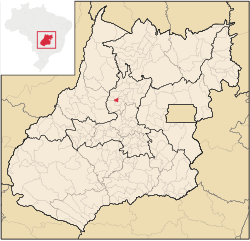 Location in Goiás state | |
 São Patrício Location in Brazil | |
| Coordinates: 15°20′54″S 49°48′50″W | |
| Country | Brazil |
| Region | Central-West |
| State | Goiás |
| Microregion | Ceres Microregion |
| Area | |
| • Total | 134.5 km2 (51.9 sq mi) |
| Elevation | 560 m (1,840 ft) |
| Population (2020 [1]) | |
| • Total | 2,037 |
| • Density | 15/km2 (39/sq mi) |
| Time zone | UTC−3 (BRT) |
| Postal code | 76343-000 |
Location
São Patrício is located 42 km. west of Ceres. Highway connections from Goiânia: GO-070 / Goianira / Inhumas / GO-154 / Itaguaru / Uruana / Carmo do Rio Verde / GO-460. See Seplan
Neighboring municipalities are Morro Agudo de Goiás, Rubiataba, Carmo do Rio Verde, Itapuranga
Demographics
- Population Density: 15.25/km² (2007)
- Urban population: 980
- Population growth rate: 1.60% 2000/2007
The economy
The economy is based on subsistence agriculture, cattle raising (19,000 head in 2006), services, public administration, and small transformation industries. There was one dairy in 2007. There were 260 farms in 2006 with 12,385 hectares of cropland and pasture. The main crops were rice (250 hectares), sugarcane (2,000 hectares), beans, manioc, passion fruit, corn (600 hectares), and tomatoes.
Health and education
There were 03 schools with 588 students (2006). The adult literacy rate was 84.0% (2000) (national average was 86.4%). In the health sector there were no hospitals. The infant mortality rate was 22.85 (2000) (national average was 33.0). The Municipal Human Development Index score was 0.728. For the complete list see frigoletto.com.br
Temperatures
→ Winter temperatures: low: 14 °C/high: 32 °C;
→ Spring temperatures: low: 23 °C/high: 36 °C;
→ Summer temperatures: low: 22 °C/high: 29 °C;
→ Autumn temperatures: low: 17 °C/high: 29 °C.
See also
- List of municipalities in Goiás
References
Capital: Goiânia | |||||||||||||||||
|  | ||||||||||||||||
|
| |||||||||||||||||
| |||||||||||||||||
| |||||||||||||||||
This Goiás, Brazil location article is a stub. You can help Wikipedia by expanding it. |
На других языках
- [en] São Patrício
[ru] Сан-Патрисиу (Гояс)
Сан-Патрисиу (порт. São Patrício) — муниципалитет в Бразилии, входит в штат Гояс. Составная часть мезорегиона Центр штата Гойас. Входит в экономико-статистический микрорегион Серис. Население составляет 2000 человек на 2007 год. Занимает площадь 134,518 км². Плотность населения — 13,7 чел./км².Другой контент может иметь иную лицензию. Перед использованием материалов сайта WikiSort.org внимательно изучите правила лицензирования конкретных элементов наполнения сайта.
WikiSort.org - проект по пересортировке и дополнению контента Википедии