world.wikisort.org - Brazil
Presidente Epitácio is a municipality in the state of São Paulo in Brazil. The town is named after Epitácio Pessoa. The population is 44,389 (2020 est.) in an area of 1260 km2.[2] The elevation is 310 m. It is situated on the Paraná River, which forms the border with Mato Grosso do Sul here.
Presidente Epitácio | |
|---|---|
Municipality | |
 Paraná River in Presidente Epitácio | |
 Flag  Coat of arms | |
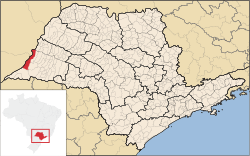 Location in São Paulo state | |
 Presidente Epitácio Location in Brazil | |
| Coordinates: 21°45′53″S 52°6′19″W | |
| Country | Brazil |
| Region | Southeast |
| State | São Paulo |
| Area | |
| • Total | 1,260 km2 (490 sq mi) |
| Elevation | 310 m (1,020 ft) |
| Population (2020 [1]) | |
| • Total | 44,389 |
| • Density | 35/km2 (91/sq mi) |
| Time zone | UTC-03:00 (BRT) |
| • Summer (DST) | UTC-02:00 (BRST) |
The municipality contains the 937 hectares (2,320 acres) Lagoa São Paulo Reserve.[3] It contains part of the 246,800 hectares (610,000 acres) Great Pontal Reserve, created in 1942.[4] It also contains 11% of the 6,677 hectares (16,500 acres) Mico Leão Preto Ecological Station, established in 2002.[5]
References
- IBGE 2020
- Instituto Brasileiro de Geografia e Estatística
- Pontal do Paranapanema (in Portuguese), IBAMA: Instituto Brasileiro do Meio Ambiente e dos Recursos Naturais Renováveis, retrieved 2016-11-13
- Pontal do Paranapanema (in Portuguese), IBAMA: Instituto Brasileiro do Meio Ambiente e dos Recursos Naturais Renováveis, retrieved 2016-11-13
- ESEC Mico Leão Preto (in Portuguese), ISA: Instituto Socioambiental, retrieved 2016-09-06
External links
- Official page from Presidente Epitácio (in Portuguese)
This geographical article relating to the state of São Paulo is a stub. You can help Wikipedia by expanding it. |
На других языках
- [en] Presidente Epitácio
[es] Presidente Epitácio
Presidente Epitácio es un municipio brasileño del estado de São Paulo. Su población es de 42.585 habitantes (estimativas IBGE/2006) y su superficie de 1.281.8 km², lo que da una densidad demográfica de 33,2 hab/km².[ru] Президенти-Эпитасиу
Президенти-Эпитасиу (порт. Presidente Epitácio) — муниципалитет в Бразилии, входит в штат Сан-Паулу. Составная часть мезорегиона Президенти-Пруденти. Входит в экономико-статистический микрорегион Президенти-Пруденти. Население составляет 39 403 человека на 2007 год. Занимает площадь 1 281,779 км². Плотность населения — 30,7 чел./км².Текст в блоке "Читать" взят с сайта "Википедия" и доступен по лицензии Creative Commons Attribution-ShareAlike; в отдельных случаях могут действовать дополнительные условия.
Другой контент может иметь иную лицензию. Перед использованием материалов сайта WikiSort.org внимательно изучите правила лицензирования конкретных элементов наполнения сайта.
Другой контент может иметь иную лицензию. Перед использованием материалов сайта WikiSort.org внимательно изучите правила лицензирования конкретных элементов наполнения сайта.
2019-2026
WikiSort.org - проект по пересортировке и дополнению контента Википедии
WikiSort.org - проект по пересортировке и дополнению контента Википедии