world.wikisort.org - Brazil
Jacupiranga is a municipality in the state of São Paulo in Brazil. The population is 17,889 (2020 est.) in an area of 704 km².[2] The elevation is 33 m.
Jacupiranga | |
|---|---|
Municipality | |
 Coat of arms | |
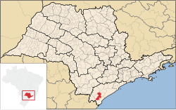 Location in São Paulo state | |
 Jacupiranga Location in Brazil | |
| Coordinates: 24°41′33″S 48°0′8″W | |
| Country | Brazil |
| Region | Southeast |
| State | São Paulo |
| Area | |
| • Total | 704 km2 (272 sq mi) |
| Population (2020 [1]) | |
| • Total | 17,889 |
| • Density | 25/km2 (66/sq mi) |
| Time zone | UTC-03:00 (BRT) |
| • Summer (DST) | UTC-02:00 (BRST) |
The municipality contains part of the 182,596 hectares (451,200 acres) Rio Turvo State Park, created in 2008.[3]
See also
- Jacupiranga State Park
References
- IBGE 2020
- Instituto Brasileiro de Geografia e Estatística
- Zanchetta, Inês; Bedeschi, Luciana (28 February 2008), Mosaico do Jacupiranga, no Vale do Ribeira, agora é lei (in Portuguese), ISA: Instituto Socioambiental, retrieved 2016-11-20
External links
| Authority control |
|
|---|
This geographical article relating to the state of São Paulo is a stub. You can help Wikipedia by expanding it. |
На других языках
- [en] Jacupiranga
[ru] Жакупиранга
Жакупиранга (порт. Jacupiranga) — муниципалитет в Бразилии, входит в штат Сан-Паулу. Составная часть мезорегиона Южное побережье штата Сан-Паулу. Входит в экономико-статистический микрорегион Режистру. Население составляет 18 970 человек на 2006 год. Занимает площадь 708,382 км². Плотность населения — 26,8 чел./км².Текст в блоке "Читать" взят с сайта "Википедия" и доступен по лицензии Creative Commons Attribution-ShareAlike; в отдельных случаях могут действовать дополнительные условия.
Другой контент может иметь иную лицензию. Перед использованием материалов сайта WikiSort.org внимательно изучите правила лицензирования конкретных элементов наполнения сайта.
Другой контент может иметь иную лицензию. Перед использованием материалов сайта WikiSort.org внимательно изучите правила лицензирования конкретных элементов наполнения сайта.
2019-2026
WikiSort.org - проект по пересортировке и дополнению контента Википедии
WikiSort.org - проект по пересортировке и дополнению контента Википедии