world.wikisort.org - Brazil
Israelândia is a municipality in eastern Goiás state, Brazil.
Israelândia | |
|---|---|
Municipality | |
 Flag  Coat of arms | |
 Location in Goiás state | |
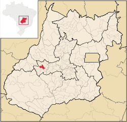
 Israelândia Location in Brazil | |
| Coordinates: 16°19′32″S 50°53′58″W | |
| Country | Brazil |
| Region | Central-West |
| State | Goiás |
| Microregion | Iporá Microregion |
| Area | |
| • Total | 577.4 km2 (222.9 sq mi) |
| Elevation | 378 m (1,240 ft) |
| Population (2020 [1]) | |
| • Total | 2,786 |
| • Density | 4.8/km2 (12/sq mi) |
| Time zone | UTC−3 (BRT) |
| Postal code | 76205-000 |
Location
Israelândia is located in the Iporá Microregion, 28 km. northeast of regional center Iporá. State capital Goiânia is 199 km. to the east. The Rio Claro, a tributary of the Rio Araguaia, flows through the municipality. Highway connections with Goiânia are made by taking state highway BR-069 west from Goiânia, through Trindade, São Luís de Montes Belos, and then 31 kilometers northeast to Amorinópolis. Neighboring municipalities: Jaupaci, Fazenda Nova, Moiporá, and Iporá.
Districts, villages, and hamlets
- District: Piloândia
Demographics
- Population growth rate 1996/2007: -1,69%
- Population in 1980: 3,583
- Population in 2007: 2,827
- Urban population in 2007: 2,137
- Rural population in 2007: 690 (Sepin)
The economy
The economy is based on services, small industries, cattle raising, and agriculture. There were 2 industrial establishments and 25 retail establishments in 2007. The cattle herd had 50,000 head. The main crops are rice, bananas, manioc, and corn, all in modest planted areas.
- GDP (PIB)(R$1,000.00): 17,792 (2005)
- GDP per capita (R$1.00): 6,393 (2005)
Motor Vehicles
- Automobiles: 132
- Pickup trucks: 21
- Number of inhabitants per motor vehicle: 18.4
Agricultural data 2006
- Farms: 290
- Total area: 52,914 ha.
- Area of permanent crops: 118 ha.
- Area of perennial crops: 742 ha.
- Area of natural pasture: 38,152 ha.
- Area of woodland and forests: 12,586 ha.
- Persons dependent on farming: 1,200
- Farms with tractors: 41
- Number of tractors: 54
- Cattle herd: 50,000 head
Education and Health(2006)
In 2006 there were 3 schools in activity with 788 students. There was one hospital with 20 beds. The literacy rate was 84.5% while the infant mortality rate was 24.39 in 1,000 live births. The score on the Municipal Human Development Index was 0.730.
History
The history of Israelândia begins in 1942 when Fernando Martins Marques discovered gold and diamonds in the Rio Claro. The first name was Monchão do Vaz when the village became a district of Iporá in 1953. In 1958 it achieved municipal status and took the name Israelândia, in honor of Israel de Amorim, who fought for its autonomy.
See also
- List of municipalities in Goiás
Microregions of Goiás
References
Capital: Goiânia | |||||||||||||||||
|  | ||||||||||||||||
|
| |||||||||||||||||
| |||||||||||||||||
| |||||||||||||||||
На других языках
- [en] Israelândia
[ru] Израэландия
Израэландия (порт. Israelândia) — муниципалитет в Бразилии, входит в штат Гояс. Составная часть мезорегиона Центр штата Гойас. Входит в экономико-статистический микрорегион Ипора. Население составляет 2840 человек на 2007 год. Занимает площадь 577,480 км². Плотность населения — 4,8 чел./км².Другой контент может иметь иную лицензию. Перед использованием материалов сайта WikiSort.org внимательно изучите правила лицензирования конкретных элементов наполнения сайта.
WikiSort.org - проект по пересортировке и дополнению контента Википедии