world.wikisort.org - Brazil
Igarapé do Lago is a district in the Brazilian municipality of Santana, in the state of Amapá. It is located along the Igarapé do Lago River, a tributary of the Vila Nova River.[2] The village has been recognized as a quilombo, a settlement by escaped slaves.[3]
Igarapé do Lago | |
|---|---|
 Church of Igarapé do Lago | |
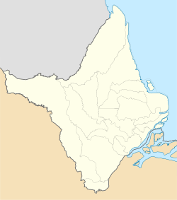 Igarapé do Lago Location in Brazil  Igarapé do Lago Igarapé do Lago (Brazil) | |
| Coordinates: 0.0718°N 51.4461°W | |
| Country | |
| Region | North |
| State | Amapá |
| Municipality | Santana |
| Founded | 1888 |
| Population (2010)[1] | |
| • Total | 651 |
| Time zone | UTC-3 |
Overview
Igarapé do Lago was founded in 1888 after the emancipation of slavery in Brazil when slaves built a settlement on the higher grounds in front of the plantation of Joana Barreto. The village is known for the annual festival of Nossa Senhora da Piedade which begins on 27 June.[4] Every winter, the lands around the river are flooded giving the area the appearance of a lake.[2] Igarapé do Lago became a district of Santana in 1987.[5]

Igarapé do Lago has a school,[6] a community centre,[7] and a police station.[8] Since 2018, Igarapé do Lago has a health care centre and an ambulance.[9] In 2011, the village was certified as a quilombo, and has been given its own territory similar to the indigenous territories.[3]
The economy is based on subsistence farming and fishing.[4] The village is connected to the BR-156 highway.[10]
The area around Igarapé do Lago is home to several archaeological sites. In 1896, three indigenous burial sites were discovered with funerary urns[11] which are shaped like seated figures with an anthropomorphic face.[12]
References
- Instituto Brasileiro de Geografia e Estatística (IBGE) (16 November 2011). "Sinopse por setores". Retrieved 1 April 2021.
- "Bem-vindo a Igarapé do Lago!". Portal Férias (in Portuguese). Retrieved 4 April 2021.
- "CERTIDÕES EXPEDIDAS ÀS COMUNIDADES REMANESCENTES DE QUILOMBOS (CRQs) ATUALIZADA ATÉ A PORTARIA No- 104/2016" (PDF). Fundação Cultural Palmares - Governo Federal (in Portuguese). Retrieved 4 April 2021.
- "Festividade de Nossa Senhora da Piedade chega aos 149 anos". Government of Amapá (in Portuguese). Retrieved 4 April 2021.
- "Santana". IBGE (in Portuguese). Retrieved 4 April 2021.
- "Comunidade de Igarapé do Lago recebe ônibus escolar e ambulância novos". Municipality of Santana (in Portuguese). Retrieved 4 April 2021.
- "Moradores do Igarapé do Lago ganham Centro Comunitário reformado pelo GEA". Socio Ambiental (in Portuguese). Retrieved 4 April 2021.
- "13º BPRU". Government of Amapá (in Portuguese). Retrieved 4 April 2021.
- "Reivindicação antiga : Distrito de Igarapé do Lago conta com ambulância e enfermeiros". Correio Amapaense (in Portuguese). Retrieved 4 April 2021.
- "Morre segunda vítima de capotamento na BR-156". Diário do Amapá (in Portuguese). Retrieved 4 April 2021.
- Lídia Lobato Leal (2010). "MARACÁ E CUNANI: IMAGEM E CONSTRUÇÃO DE IDENTIDADE PARA O AMAPÁ" (PDF). Centro de Estudos Multidisciplinares em Cultura (in Portuguese). pp. 3–4.
- Polo, Mario Junior Alves (25 April 2020). "Para além do Igarapé do Lago". Revista de Arqueologia (in Portuguese). 33 (1): 126–145. doi:10.24885/sab.v33i1.720. S2CID 219002001. Retrieved 4 April 2021.
Другой контент может иметь иную лицензию. Перед использованием материалов сайта WikiSort.org внимательно изучите правила лицензирования конкретных элементов наполнения сайта.
WikiSort.org - проект по пересортировке и дополнению контента Википедии