world.wikisort.org - Brazil
Capela do Alto is a municipality in the state of São Paulo in Brazil. It is part of the Metropolitan Region of Sorocaba.[2] The population is 20,985 (2020 est.) in an area of 169.89 km².[3] The elevation is 625 m.
Capela do Alto | |
|---|---|
Municipality | |
 Coat of arms | |
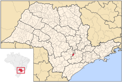 Location in São Paulo state | |
 Capela do Alto Location in Brazil | |
| Coordinates: 23°28′14″S 47°44′05″W | |
| Country | Brazil |
| Region | Southeast |
| State | São Paulo |
| Metrop. region | Sorocaba |
| Area | |
| • Total | 169.89 km2 (65.59 sq mi) |
| Elevation | 625 m (2,051 ft) |
| Population (2020 [1]) | |
| • Total | 20,985 |
| • Density | 120/km2 (320/sq mi) |
| Time zone | UTC-03:00 (BRT) |
| • Summer (DST) | UTC-02:00 (BRST) |
| Postal code | 18195 |
| Area code | +55 15 |
| Website | www |
Population history
| Year | Pop. | ±% |
|---|---|---|
| 2001 | 14,247 | — |
| 2004 | 16,030 | +12.5% |
| 2015 | 19,482 | +21.5% |
Demographics
According to the 2000 IBGE Census, the population was 14,247, of which 11,111 are urban and 3,136 are rural. The average life expectancy was 69.31 years. The literacy rate was 89.43%.
References
- IBGE 2020
- "Governo do Estado de São Paulo, Lei Complementar nº 1.241, de 8 de maio de 2014". Archived from the original on 2014-10-18. Retrieved 2015-09-29.
- Instituto Brasileiro de Geografia e Estatística
External links
- (in Portuguese) http://www.capeladoalto.sp.gov.br
- (in Portuguese) Capela do Alto on citybrazil.com.br[permanent dead link]
This geographical article relating to the state of São Paulo is a stub. You can help Wikipedia by expanding it. |
На других языках
- [en] Capela do Alto
[ru] Капела-ду-Алту
Капела-ду-Алту (порт. Capela do Alto) — муниципалитет в Бразилии. входит в штат Сан-Паулу. Составная часть мезорегиона Макрорегион агломерации Сан-Паулу. Входит в экономико-статистический микрорегион Сорокаба, который входит в Макрорегион агломерации Сан-Паулу. Население составляет 16 816 человек на 2006 год. Занимает площадь 169,981 км². Плотность населения — 98,9 чел./км².Текст в блоке "Читать" взят с сайта "Википедия" и доступен по лицензии Creative Commons Attribution-ShareAlike; в отдельных случаях могут действовать дополнительные условия.
Другой контент может иметь иную лицензию. Перед использованием материалов сайта WikiSort.org внимательно изучите правила лицензирования конкретных элементов наполнения сайта.
Другой контент может иметь иную лицензию. Перед использованием материалов сайта WikiSort.org внимательно изучите правила лицензирования конкретных элементов наполнения сайта.
2019-2026
WikiSort.org - проект по пересортировке и дополнению контента Википедии
WikiSort.org - проект по пересортировке и дополнению контента Википедии