world.wikisort.org - Brazil
Araçoiaba da Serra is a city in the state of São Paulo in Brazil. It is part of the Metropolitan Region of Sorocaba.[2] The population is 34,776 (2020 est.) in an area of 255.33 km².[3] The elevation is 625 m. The name Araçoiaba comes from the Tupi language, meaning "hider of the sun". This name comes from a single mountain nearby that the natives noted hid the sun as it set in the area.
Araçoiaba da Serra | |
|---|---|
Municipality | |
 Flag  Coat of arms | |
 Location in São Paulo state | |
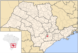
 Araçoiaba da Serra Location in Brazil | |
| Coordinates: 23°30′19″S 47°36′51″W | |
| Country | |
| Region | Southeast Brazil |
| State | São Paulo |
| Metropolitan Region | Sorocaba |
| Area | |
| • Total | 255.33 km2 (98.58 sq mi) |
| Elevation | 625 m (2,051 ft) |
| Population (2020[1]) | |
| • Total | 34,776 |
| • Density | 140/km2 (350/sq mi) |
| Time zone | UTC-3 (BRT) |
| • Summer (DST) | UTC-2 (BRST) |
| Website | www |
Population history
| Year | Population |
|---|---|
| 2001 | 19,816 |
| 2004 | 22,521 |
| 2015 | 31,321 |
Demographics
According to the 2000 IBGE Census, the population was 19,816, of which 13,679 are urban and 6,137 are rural. The average life expectancy was 71.1 years. The literacy rate was at 92.14%.
References
- IBGE 2020
- "Governo do Estado de São Paulo, Lei Complementar nº 1.241, de 8 de maio de 2014". Archived from the original on 2014-10-18. Retrieved 2015-09-29.
{{cite web}}: CS1 maint: bot: original URL status unknown (link) - Instituto Brasileiro de Geografia e Estatística
External links
- (in Portuguese) http://www.aracoiaba.sp.gov.br Archived 2016-04-14 at the Wayback Machine
- (in Portuguese) Araçoiaba da Serra on citybrazil.com.br
This geographical article relating to the state of São Paulo is a stub. You can help Wikipedia by expanding it. |
На других языках
- [en] Araçoiaba da Serra
[ru] Арасояба-да-Серра
Арасояба-да-Серра (порт. Araçoiaba da Serra) — муниципалитет в Бразилии, входит в штат Сан-Паулу. Составная часть мезорегиона Макрорегион агломерации Сан-Паулу. Входит в экономико-статистический микрорегион Сорокаба. Население составляет 23 713 человека на 2006 год. Занимает площадь 255,550 км². Плотность населения — 92,8 чел./км².Текст в блоке "Читать" взят с сайта "Википедия" и доступен по лицензии Creative Commons Attribution-ShareAlike; в отдельных случаях могут действовать дополнительные условия.
Другой контент может иметь иную лицензию. Перед использованием материалов сайта WikiSort.org внимательно изучите правила лицензирования конкретных элементов наполнения сайта.
Другой контент может иметь иную лицензию. Перед использованием материалов сайта WikiSort.org внимательно изучите правила лицензирования конкретных элементов наполнения сайта.
2019-2026
WikiSort.org - проект по пересортировке и дополнению контента Википедии
WikiSort.org - проект по пересортировке и дополнению контента Википедии