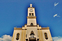
world.wikisort.org - Brazil
Apucarana is a municipality in the state of Paraná in Brazil. The municipality covers 548 square kilometres (212 sq mi) at an elevation of 840 metres (2,760 ft) above mean sea level. Its 2020 population was estimated as 136,234.[1]
Apucarana | |
|---|---|
 | |
 | |
 Apucarana Location in Brazil | |
| Coordinates: 23°33′03″S 51°27′39″W | |
| Country | |
| Region | South |
| State | |
| Founded | 1944 |
| Area | |
| • Total | 548 km2 (212 sq mi) |
| Elevation | 840 m (2,760 ft) |
| Population (2020) | |
| • Total | 136,234 |
| • Density | 250/km2 (640/sq mi) |
| Demonym | Apucaranense |
| Time zone | UTC-3 (UTC-3) |
| Postal code | 86800 |
| Area code | (+55) 43 |
| Website | Official website (in Portuguese) |
Transportation
The city is served by Cap. João Busse Airport[2] which is located 10 kilometers (5 nautical miles) southeast of Apucarana.[3]
Economy
In agriculture, the city stands in production of coffee, soy, beans and corn. The industry stands out for leather production (3% of Brazil's total) and the manufacturing of caps (80% of production in Brazil).
Culture
![Cherry blossom in Apucarana. The first hundred trees were planted by Japanese descendants in the 1980s. Today the city has more than 20.000 sakuras.[4]](http://upload.wikimedia.org/wikipedia/commons/thumb/a/a6/Apucpref.jpg/220px-Apucpref.jpg)
The city received thousands of immigrants from Portugal, Ukraine, Poland, Germany and especially from Japan (who did strong influence in culture like in the Buddhist religion and the amount of cherry trees planted - the city has more than 20,000 sakuras and annually do the "Cherry Festival" to celebrate the Japanese culture[4]).
| Races | |
|---|---|
| White | 71.95% |
| Brown | 17.84% |
| Black | 5.97% |
| Asian | 3.77% |
| Natives | 0.47% |
source : PARDES 2010
Religion
The city is the seat of the Roman Catholic Diocese of Apucarana.
References
- IBGE 2020
- Apucarana - SSAP (Cap. João Busse) Archived July 6, 2011, at the Wayback Machine at official Paraná website. Retrieved 2008-09-18.
- Distance & heading from Apucarana to airport (SSAP) as calculated by Great Circle Mapper. Retrieved 2008-09-18.
- "Cerejeiras enfeitam cidade no norte do Paraná" (in Portuguese). Jornal Nacional. Retrieved 2011-07-15.
External links
- Prefeitura Municipal de Apucarana (City of Apucarana)
- Informações sobre a Cidade (Business and Information from Apucarana)
На других языках
[de] Apucarana
Apucarana, amtlich portugiesisch Município de Apucarana, ist eine Stadt im brasilianischen Bundesstaat Paraná. Im Volkszählungsjahr 2010 hatte sie 120.919 Einwohner, die zum 1. Juli 2021 auf 137.438 Personen geschätzt wurden und auf einer Gemeindefläche von rund 558,4 km² leben. Die Bevölkerungsdichte liegt rechnerisch bei 216 Personen pro km², über 94 % der Bevölkerung der Apucaranenser konzentrieren sich jedoch auf den urbanen Bereich. Sie steht an 11. Stelle der 399 Munizips des Bundesstaates.[1]- [en] Apucarana
[ru] Апукарана
Апукарана (порт. Apucarana) — муниципалитет в Бразилии, входит в штат Парана. Составная часть мезорегиона Северо-центральная часть штата Парана. Входит в экономико-статистический микрорегион Апукарана. Население составляет 121 290 человека на 2009 год. Занимает площадь 558,388 км². Плотность населения — 210,0 чел./км².Другой контент может иметь иную лицензию. Перед использованием материалов сайта WikiSort.org внимательно изучите правила лицензирования конкретных элементов наполнения сайта.
WikiSort.org - проект по пересортировке и дополнению контента Википедии

