world.wikisort.org - Bangladesh
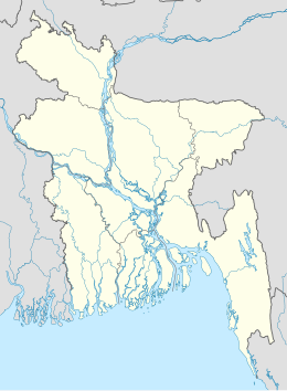
Sitakunda è un sottodistretto (upazila) del Bangladesh situato nel distretto di Chittagong, divisione di Chittagong. Si estende su una superficie di 483,97 km² e conta una popolazione di 335.178 abitanti (dato censimento 1991)[1].
| Sitakunda upazila | |
|---|---|
| Localizzazione | |
| Stato | |
| Divisione | Chittagong |
| Distretto | Chittagong |
| Territorio | |
| Coordinate | 22°37′00″N 91°39′42″E |
| Altitudine | 6 m s.l.m. |
| Superficie | 483,97 km² |
| Abitanti | 335 178[1] (1991) |
| Densità | 692,56 ab./km² |
| Altre informazioni | |
| Cod. postale | 4311 |
| Fuso orario | UTC+6 |
| Cartografia | |
 Sitakunda | |
| Sito istituzionale | |
Note
- (EN) Population Census of Bangladesh, su bangladeshgov.org, Bangladesh Bureau of Statistics. URL consultato il 31 dicembre 2016 (archiviato dall'url originale il 27 marzo 2005).
Collegamenti esterni
- Sito ufficiale, su sitakunda.chittagong.gov.bd.
| Controllo di autorità | VIAF (EN) 149047906 · LCCN (EN) n89275324 |
|---|
На других языках
[en] Sitakunda Upazila
Sitakunda (Bengali: সীতাকুণ্ড Shitakunḍo, IPA: [ʂitakunɖo]) is an upazila in the Chattogram District of Chattogram Division, Bangladesh. It includes one urban settlement, the Sitakunda Town, and 10 unions. Sitakunda is the home of the country's first eco-park, as well as alternative energy projects, specifically wind energy and geothermal power.- [it] Sitakunda
Текст в блоке "Читать" взят с сайта "Википедия" и доступен по лицензии Creative Commons Attribution-ShareAlike; в отдельных случаях могут действовать дополнительные условия.
Другой контент может иметь иную лицензию. Перед использованием материалов сайта WikiSort.org внимательно изучите правила лицензирования конкретных элементов наполнения сайта.
Другой контент может иметь иную лицензию. Перед использованием материалов сайта WikiSort.org внимательно изучите правила лицензирования конкретных элементов наполнения сайта.
2019-2025
WikiSort.org - проект по пересортировке и дополнению контента Википедии
WikiSort.org - проект по пересортировке и дополнению контента Википедии