world.wikisort.org - Bangladesh
Goalundo Ghat, nota anche solamente come Goalundo, è un centro abitato del Bangladesh centrale appartenente all'upazila di Goalandaghat. È situata presso la confluenza tra i fiumi Padma (Gange) e Jamuna (Brahmaputra).
| Goalundo Ghat centro abitato | |
|---|---|
 | |
| Localizzazione | |
| Stato | |
| Divisione | Dacca |
| Distretto | Rajbari |
| Upazila | Goalandaghat |
| Territorio | |
| Coordinate | 23°43′28″N 89°44′42″E |
| Superficie | 149,03 km² |
| Abitanti | 18 663 (2011) |
| Densità | 125,23 ab./km² |
| Altre informazioni | |
| Fuso orario | UTC+6 |
| Cartografia | |
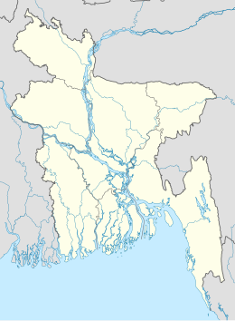 Goalundo Ghat | |
| Sito istituzionale | |
Goalundo Ghat è collegata da una strada a Faridpur e Kushtia ed è un importante terminal per traghetti e treni. Tra le principali materie prime che esporta vi sono riso, iuta, semi oleosi, canna da zucchero e pesce. Tra le industrie vi sono impianti per la lavorazione del riso e per la fabbricazione di ghiaccio e candele.
Bibliografia
- Istituto Geografico De Agostini. Il Milione, vol. VII (Regione iranica - Regione indiana), pagg. 547-550. Novara, 1962.
- Mikey Leung, Belinda Meggitt, Bangladesh, Bradt Travel Guides (2012). ISBN 978-18-4162-409-9.
- Istituto Geografico De Agostini. Enciclopedia geografica, edizione speciale per il Corriere della Sera, vol. 8, pag. 295-297. RCS Quotidiani s.p.a., Milano, 2005. ISSN 1824-928306.
Altri progetti
 Wikimedia Commons contiene immagini o altri file su Goalundo Ghat
Collegamenti esterni
- Sito ufficiale (GIF), su bangladesh.gov.bd.
- (EN) Goalundo Ghat, su Enciclopedia Britannica, Encyclopædia Britannica, Inc.
На других языках
[en] Goalundo Ghat
Goalundo Ghat (also spelled Goalanda and Goalondo; Bengali: গোয়ালন্দঘাট) is a small town and pourasabha in Goalandaghat Upazila, Rajbari District, Dhaka Division, Bangladesh, South Asia. There are two railway stops one at Goalundo Ghat and one at Goalundo Bazar.[1] The town has an area of 4.86 km2 and a population of 22,000 inhabitants (2001 estimate).[2]- [it] Goalundo Ghat
Текст в блоке "Читать" взят с сайта "Википедия" и доступен по лицензии Creative Commons Attribution-ShareAlike; в отдельных случаях могут действовать дополнительные условия.
Другой контент может иметь иную лицензию. Перед использованием материалов сайта WikiSort.org внимательно изучите правила лицензирования конкретных элементов наполнения сайта.
Другой контент может иметь иную лицензию. Перед использованием материалов сайта WikiSort.org внимательно изучите правила лицензирования конкретных элементов наполнения сайта.
2019-2025
WikiSort.org - проект по пересортировке и дополнению контента Википедии
WikiSort.org - проект по пересортировке и дополнению контента Википедии