world.wikisort.org - L'Autriche
Ottakring, le seizième arrondissement de Vienne, est né de la fusion en 1892 des anciennes communes d'Ottakring et de Neulerchenfeld.
| Ottakring | |
 Héraldique |
|

| |
| Administration | |
|---|---|
| Pays | |
| Land | |
| Statut | Arrondissement |
| District (Bezirk) |
Vienne |
| Conseillers municipaux | 60 conseillers 24 SPÖ, 5 ÖVP, 10 Grüne, 17 FPÖ, 3 Neos, 1 Andas |
| Maire | Franz Prokop (SPÖ) |
| Code postal | A-1160 |
| Immatriculation | W |
| Indicatif | +43 (0)1 |
| Démographie | |
| Population | 103 785 hab. (2019) |
| Densité | 11 971 hab./km2 |
| Géographie | |
| Coordonnées | 48° 12′ 45″ nord, 16° 18′ 38″ est |
| Altitude | 247 m |
| Superficie | 867 ha = 8,67 km2 |
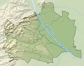
| Localisation | |
 Localisation en Autriche | |
| Liens | |
| Site web | http://www.wien.gv.at/ottakring Courriel |
| modifier |
|
Ottakring est connu pour la bière Ottakringer.
Articles connexes
- Arrondissements de Vienne
- Communautés cadastrales de Vienne
- Portail de Vienne
На других языках
[en] Ottakring
Ottakring (German pronunciation: [ˈɔtɐˌkʀɪŋ] (listen)) is the 16th District in the city of Vienna, Austria (German: 16. Bezirk, Ottakring). It is located west of the central districts, north of Penzing and south of Hernals.[2] Ottakring has some heavily populated urban areas with many residential buildings.[1][2] It was formed from the independent villages of Ottakring and Neulerchenfeld in 1892.- [fr] Ottakring
Текст в блоке "Читать" взят с сайта "Википедия" и доступен по лицензии Creative Commons Attribution-ShareAlike; в отдельных случаях могут действовать дополнительные условия.
Другой контент может иметь иную лицензию. Перед использованием материалов сайта WikiSort.org внимательно изучите правила лицензирования конкретных элементов наполнения сайта.
Другой контент может иметь иную лицензию. Перед использованием материалов сайта WikiSort.org внимательно изучите правила лицензирования конкретных элементов наполнения сайта.
2019-2025
WikiSort.org - проект по пересортировке и дополнению контента Википедии
WikiSort.org - проект по пересортировке и дополнению контента Википедии


