world.wikisort.org - L'Autriche
Großlobming est une commune autrichienne du district de Murtal en Styrie.
Cet article est une ébauche concernant une localité autrichienne.
Vous pouvez partager vos connaissances en l’améliorant (comment ?) selon les recommandations des projets correspondants.
| Großlobming | ||||
 Héraldique |
||||

| ||||
| Administration | ||||
|---|---|---|---|---|
| Pays | ||||
| Land | ||||
| District (Bezirk) |
Murtal | |||
| Code postal | A- | |||
| Indicatif | 43+ | |||
| Géographie | ||||
| Coordonnées | 47° 10′ 00″ nord, 14° 48′ 00″ est | |||
| Altitude | 614 m |
|||
| Superficie | 737 ha = 7,37 km2 | |||
| Localisation | ||||
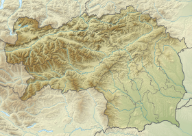
| Géolocalisation sur la carte : Styrie
Géolocalisation sur la carte : Autriche
Géolocalisation sur la carte : Autriche
| ||||
| modifier |
||||


Géographie
Cette section est vide, insuffisamment détaillée ou incomplète. Votre aide est la bienvenue ! Comment faire ?
Histoire
Cette section est vide, insuffisamment détaillée ou incomplète. Votre aide est la bienvenue ! Comment faire ?
 Portail de l'Autriche
На других языках
[de] Großlobming
Großlobming ist eine Ortschaft, Katastralgemeinde und ehemalige Gemeinde (bis Ende 2015) mit 1192 Einwohnern (Stand 1. Jänner 2015) im Bezirk Murtal und Gerichtsbezirk Judenburg in der Steiermark. Der Ort befindet sich auf einer Höhe von 641 m und hat eine Fläche von 736,67 ha.[en] Großlobming
Großlobming is a municipality in the district of Murtal in Styria, Austria. It is located on the banks of the river Mur.- [fr] Großlobming
Текст в блоке "Читать" взят с сайта "Википедия" и доступен по лицензии Creative Commons Attribution-ShareAlike; в отдельных случаях могут действовать дополнительные условия.
Другой контент может иметь иную лицензию. Перед использованием материалов сайта WikiSort.org внимательно изучите правила лицензирования конкретных элементов наполнения сайта.
Другой контент может иметь иную лицензию. Перед использованием материалов сайта WikiSort.org внимательно изучите правила лицензирования конкретных элементов наполнения сайта.
2019-2026
WikiSort.org - проект по пересортировке и дополнению контента Википедии
WikiSort.org - проект по пересортировке и дополнению контента Википедии